2020 · GS Paper 1 · Q4 · 10 marks
Discuss the geophysical characteristics of Circum-Pacific Zone.
In short
The Circum-Pacific Zone is a 40,000 km belt of convergent plate margins marked by subduction, deep trenches, island arcs, Benioff-zone earthquakes and explosive andesitic volcanoes. It holds about 75% of the world's volcanoes and about 90% of its earthquakes, including the record Valdivia quake of 1960.
Model answer
Ghissu Editorial · Verified 4 Oct 2026 · 277 words
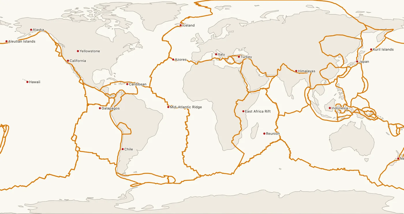
Convergent margins and trenches
The Pacific, Nazca and other oceanic plates subduct along the ring, carving trenches like the Mariana, whose Challenger Deep is about 11 km deep.
Island arcs and cordilleras
Ocean-ocean convergence builds arcs such as Japan and the Aleutians, and ocean-continent convergence raises the Andes and the Cascades.
Transform segments
The San Andreas Fault in California and the Alpine Fault in New Zealand show the ring also has transform boundaries with shallow earthquakes.
Benioff zone earthquakes
Foci deepen along the sinking slab to about 700 km, and the largest recorded quakes struck here, including Valdivia, Chile (1960, M9.5).
Explosive andesitic volcanoes
Gas-rich andesitic magma builds stratovolcanoes such as Fuji and Pinatubo (1991), whose sulphur cooled global temperatures by about 0.5°C.
Tsunamis
Megathrust ruptures, as off Japan in 2011, lift the sea floor and send tsunamis across the basin, monitored since 1949 by the Pacific Tsunami Warning Center.
Geothermal and mineral wealth
Heat flow powers geothermal plants in the Philippines and New Zealand, and magmatic fluids formed Chile's copper belts.
This model answer is indicative and the model can make mistakes; please verify key facts independently.
Practise this question
1Get the answer sheet
Sized for this question.
2Write your answer
Timed, by hand.
3Get it marked
Your score and what to fix.
This chapter in the exam
The Earth2 questions
Asked in 2 of 14 sittings since 2013
Question from the official UPSC Civil Services (Main) Examination 2020 paper. Answer written by Ghissu's engine and checked against our editorial standards. Found an error? Tell us and we correct it within 48 hours.