2026 · GS Paper 3 · Q15 · 15 marks
Mention salient features of 'Mission Drishti'. Discuss the imaging techniques used in the satellite launched on 3rd May 2026. Why it is being considered world's first satellite of its kind? (Answer in 250 words)
In short
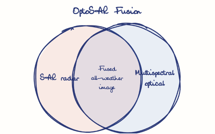
Mission Drishti, launched by GalaxEye on 3 May 2026, is India's largest privately built Earth observation satellite and the world's first OptoSAR satellite. It carries an X-band SAR and a seven-band multispectral imager on one platform, fusing them into all-weather, day-and-night images.
Model answer
Ghissu Editorial · Verified 4 Oct 2026 · 277 words
Private and indigenous
Built by an IIT Madras-incubated start-up, it reflects the opening of space to private firms under IN-SPACe and the Indian Space Policy 2023.
Platform
The roughly 190 kg satellite flies in a sun-synchronous orbit at about 500 km, revisiting a spot about every four days at roughly 1.2 to 3.6 metre resolution.
Constellation seed
It is the first of a planned Drishti constellation for defence, disaster response, agriculture and infrastructure monitoring.
Synthetic Aperture Radar
An X-band radar sends microwave pulses and records their echoes, so it images through cloud, smoke and darkness.
Multispectral imager
A seven-band optical sensor records reflected sunlight in several wavelengths, giving true-colour pictures and indices of crops, water and vegetation.
SyncFusion
Both sensors view the same ground together, and AI-driven processing merges them into one fused product.
Two sensors, one satellite
Missions like Sentinel-1 and Sentinel-2 carry radar and optics on separate satellites imaging at different times; Drishti is the first to carry both on one platform.
Simultaneous capture
Removing the time gap between radar and optical images gives reliable change detection during monsoon floods, over cloud-covered borders and at night.
This model answer is indicative and the model can make mistakes; please verify key facts independently.
Practise this question
1Get the answer sheet
Sized for this question.
2Write your answer
Timed, by hand.
3Get it marked
Your score and what to fix.
This chapter in the exam
Space8 questions
Asked in 8 of 14 sittings since 2013
- 2024What are asteroids? How real is the threat of them causing extinction of life? What strategies have been developed to prevent such a catastrophe?
- 2023What is the main task of India's third moon mission which could not be achieved in its earlier mission? List the countries that have achieved this task. Introduce the subsystems in the spacecraft launched and explain the role of the 'Virtual Launch Control Centre' at the Vikram Sarabhai Space Centre which contributed to the successful launch from Sriharikota.
All 8 questions, sorted by sub-topic, with model answers and practice.
Question from the official UPSC Civil Services (Main) Examination 2026 paper. Answer written by Ghissu's engine and checked against our editorial standards. Found an error? Tell us and we correct it within 48 hours.