What are the significant features of INSAT-3D?
In short
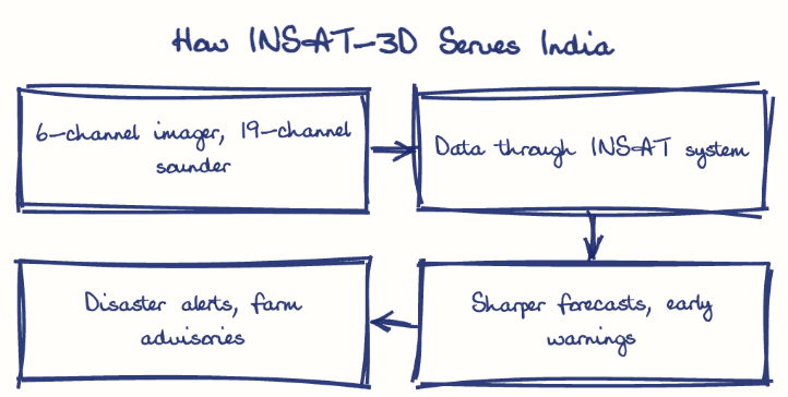
INSAT-3D is an indigenous ISRO geostationary meteorological satellite carrying a 6-channel imager and a 19-channel sounder for detailed weather and atmospheric observation over the subcontinent. It derives products like sea surface temperature, rainfall and fog maps, and carries a Data Relay Transponder and a search-and-rescue payload.
Model answer
Ghissu Editorial · Verified 4 Oct 2026 · 277 words
Advanced Payloads and Integration
Launched in 2013, it carries a 6-channel imager and India's first 19-channel atmospheric sounder, and operating within the INSAT network it ensures seamless meteorological data flow, benefiting both urban and rural areas of Telangana.
Disaster Management Support
Real-time data facilitates timely cyclone and heavy rainfall alerts and damage assessment for disaster authorities, including in Telangana.
Sustainability Needs
Continuous upgrades and replacements like INSAT-3DR are essential for maintaining service quality and technological relevance over time.
Agricultural and Water Management
Satellite data aids cropping and irrigation decisions, boosting productivity and reducing climate vulnerability in Telangana.
Urban Planning and Geophysical Products
Sea surface temperature, rainfall and fog products support urban planning in Hyderabad and monsoon monitoring in Telangana.
Search and Rescue
Its Data Relay Transponder and search-and-rescue payload relay data from weather stations and distress signals from ships and aircraft.
Strengthen Ground Infrastructure
Expand and modernize ground receiving stations and data networks in Telangana to ensure timely access and effective utilization of INSAT-3D data.
Enhance Indigenous R&D
Invest in next-generation meteorological payloads and satellite technologies within ISRO to sustain technological sovereignty and improve satellite lifespan.
Promote User Awareness and Training
Conduct capacity-building programs for farmers, disaster managers, and urban planners in Telangana to maximize the benefits of satellite data.
This model answer is indicative and the model can make mistakes; please verify key facts independently.
Sources
Practise this question
1Get the answer sheet
Sized for this question.
2Write your answer
Timed, by hand.
3Get it marked
Your score and what to fix.
This chapter in the exam
Indian space programme3 questions
Asked in 2 of 2 sittings since 2016
Most tested: Flagship ISRO missions and their objectives/significance.
Question from the official TGPSC Group-I Mains 2016 paper. Answer written by Ghissu's engine and checked against our editorial standards. Found an error? Tell us and we correct it within 48 hours.