2013 · GS Paper 1 · Q22(b) · 5 marks
There is no formation of deltas by rivers of the Western Ghats. Why?
In short
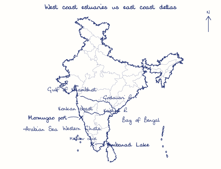
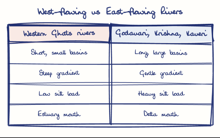
Western Ghats rivers build no deltas because their courses are short and steep, their hard-rock catchments yield little silt, and the narrow, wave-washed submergent western coast leaves no room for deposition. They end instead in estuaries such as the Mandovi and Zuari and in Kerala's backwaters.
Model answer
Ghissu Editorial · Verified 4 Oct 2026 · 299 words
Short courses
The Ghats lie only about 50 to 80 km from the sea in most places, so the rivers have short runs and small catchments that yield little silt.
Steep gradient
They plunge down the western escarpment, as at Jog Falls on the Sharavati, and carry their load straight into the sea.
Hard rock catchment
Resistant basalt and gneiss weather slowly, keeping the sediment load low despite heavy rain.
Narrow coastal plain
The Konkan and Malabar plains leave no broad lowland for distributaries to spread.
Coastal dynamics
The largely submergent western coast faces strong Arabian Sea waves that remove the little silt arriving; even the long Narmada and Tapi form estuaries in the high-tide Gulf of Khambhat.
Estuaries and backwaters
The rivers end in estuaries like the Mandovi and Zuari in Goa, and in Kerala they feed lagoons and backwaters such as Vembanad.
This model answer is indicative and the model can make mistakes; please verify key facts independently.
Practise this question
1Get the answer sheet
Sized for this question.
2Write your answer
Timed, by hand.
3Get it marked
Your score and what to fix.
This chapter in the exam
Physiography1 question
Asked in 1 of 14 sittings since 2013
Question from the official UPSC Civil Services (Main) Examination 2013 paper. Answer written by Ghissu's engine and checked against our editorial standards. Found an error? Tell us and we correct it within 48 hours.