2014 · GS Paper 1 · Q20 · 10 marks
Bring out the relationship between the shrinking Himalayan glaciers and the symptoms of climate change in the Indian sub-continent.
In short
Climate warming, less snowfall and black carbon are shrinking Himalayan glaciers, and that shrinkage in turn produces the subcontinent's climate symptoms of glacial lake outbursts, unstable slopes and erratic river flows. ICIMOD found Hindu Kush Himalayan glaciers disappearing about 65% faster in 2011-2020 than in the previous decade.
Model answer
Ghissu Editorial · Verified 4 Oct 2026 · 272 words
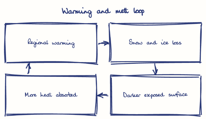
Rising temperatures
IMD records warming of about 0.68°C per century over India (1901-2025), faster in the high Himalayas; Raina's MoEFCC paper (2009) found Gangotri retreating roughly 20 m a year through much of the twentieth century.
Less snow, more soot
Warmer winters bring rain instead of snow, while black carbon from crop burning and diesel darkens the ice.
Accelerating loss
ICIMOD (2023) found Hindu Kush Himalayan glaciers disappearing about 65% faster in 2011-2020 than in the previous decade.
Glacial lake outbursts
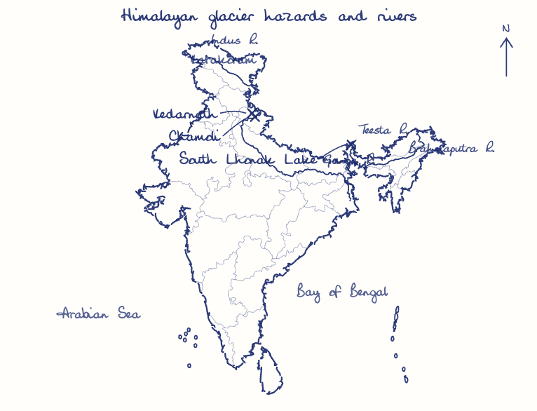
The South Lhonak outburst in Sikkim (October 2023) destroyed the Teesta III dam.
Erratic river flows
Snow and glacier melt sustain the Indus and the lean-season Ganga, so early floods and lean-season shortages threaten irrigation and hydropower.
Unstable slopes
Kedarnath (2013) and the Chamoli rock-and-ice avalanche (2021) show how thinning ice loosens slopes.
An uneven signal
Stable Karakoram glaciers and Ladakh's barely retreating Kangriz show the trend varies by region.
This model answer is indicative and the model can make mistakes; please verify key facts independently.
Practise this question
1Get the answer sheet
Sized for this question.
2Write your answer
Timed, by hand.
3Get it marked
Your score and what to fix.
This chapter in the exam
Climate12 questions
Asked in 9 of 14 sittings since 2013
- 2026What is the Fujiwara effect? Explain its impact on the movement and intensity of tropical cyclones.
- 2026"Tundra regions are ecologically fragile but economically important." Examine this statement critically.
All 12 questions, sorted by sub-topic, with model answers and practice.
Question from the official UPSC Civil Services (Main) Examination 2014 paper. Answer written by Ghissu's engine and checked against our editorial standards. Found an error? Tell us and we correct it within 48 hours.