2014 · GS Paper 1 · Q18 · 10 marks
Explain the formation of thousands of islands in Indonesian and Philippines archipelagoes.
In short
The islands of Indonesia and the Philippines formed mainly as volcanic island arcs where the Indo-Australian and Philippine Sea plates subduct, aided by microplate collision, post-glacial drowning of the Sunda Shelf and coral growth. Subduction along the Java and Philippine trenches built volcanoes such as Krakatoa, Tambora and Pinatubo.
Model answer
Ghissu Editorial · Verified 4 Oct 2026 · 284 words
Sunda subduction arc
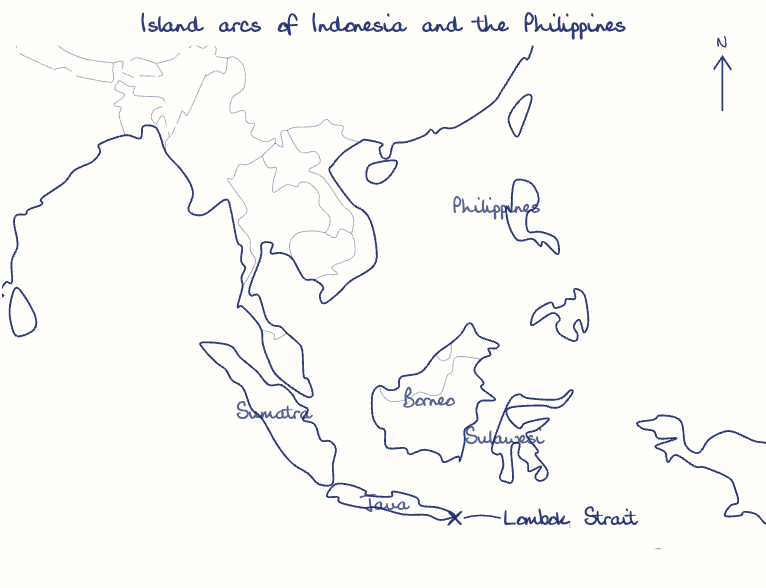
The Indo-Australian plate dives beneath the Sunda plate along the Java Trench, building the volcanic chain of Sumatra, Java, Bali and Flores, with Krakatoa and Tambora.
Double subduction
The Philippine Sea plate sinks along the Philippine Trench and the South China Sea floor along the Manila Trench, raising arcs with Pinatubo, Mayon and Taal.
Collision and faulting
Jammed microplates explain the K shape of Sulawesi and the uplift of Timor, while the Philippine Fault Zone slices and raises separate crustal blocks.
Drowned Sunda Shelf
Sumatra, Java and Borneo were joined when Ice Age seas stood about 120 metres lower; post-glacial melting flooded the lowlands and left the uplands as islands.
Sahul Shelf
New Guinea rises from the Sahul Shelf, once joined to Australia, while deep straits such as Lombok kept Wallacea isolated, which is why Wallace's Line divides Asian and Australian fauna.
Coral islands
Warm waters of the Coral Triangle let reefs, cays and raised coral limestone islands grow, as at Tubbataha Reef.
This model answer is indicative and the model can make mistakes; please verify key facts independently.
Practise this question
1Get the answer sheet
Sized for this question.
2Write your answer
Timed, by hand.
3Get it marked
Your score and what to fix.
This chapter in the exam
The Earth7 questions
Asked in 6 of 14 sittings since 2013
- 2025Discuss how the changes in shape and sizes of continents and ocean basins of the planet take place due to tectonic movements of the crustal masses.
- 2022Discuss the natural resource potentials of Deccan Trap.
All 7 questions, sorted by sub-topic, with model answers and practice.
Question from the official UPSC Civil Services (Main) Examination 2014 paper. Answer written by Ghissu's engine and checked against our editorial standards. Found an error? Tell us and we correct it within 48 hours.