2014 · GS Paper 1 · Q19 · 10 marks
Tropical cyclones are largely confined to South China Sea, Bay of Bengal and Gulf of Mexico. Why?
In short
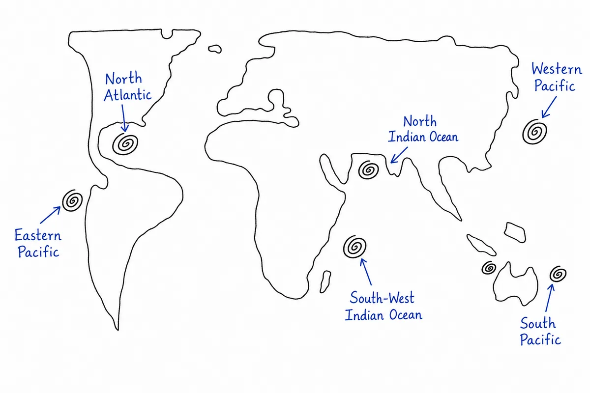
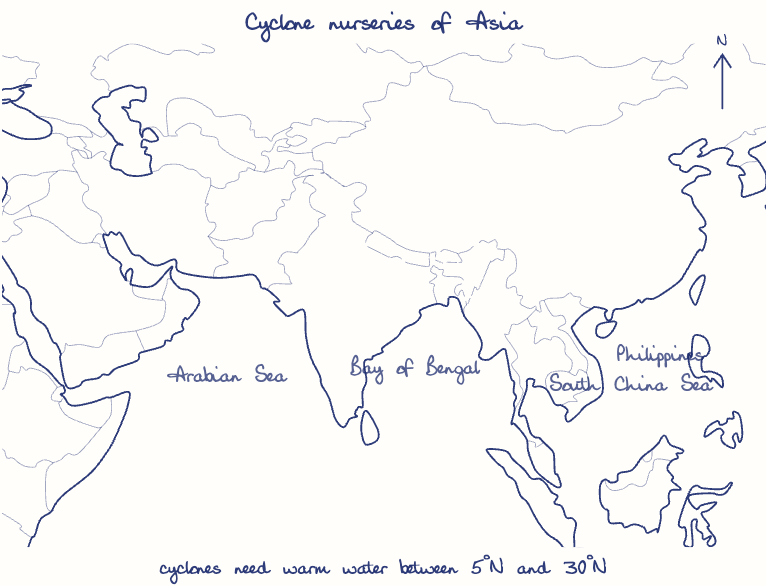
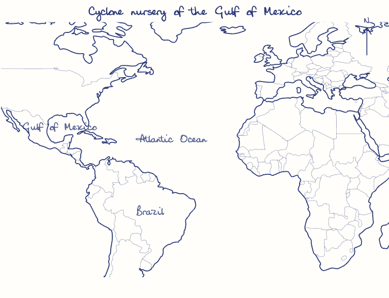
Tropical cyclones concentrate in the South China Sea, Bay of Bengal and Gulf of Mexico because warm water above 26.5°C, adequate Coriolis force, ready disturbances and low wind shear coincide there. Cold eastern-ocean currents, South Atlantic shear and weak equatorial Coriolis force deny cyclones elsewhere.
Model answer
Ghissu Editorial · Verified 4 Oct 2026 · 282 words
Warm water pools
These semi-enclosed tropical seas stay above 26.5°C to about 50 m.
Right latitude band
Lying mostly between about 5°N and 30°N, they get enough Coriolis force to spin storms while staying warm.
Ready-made disturbances
The monsoon trough seeds Bay of Bengal and South China Sea depressions, easterly waves from Africa feed the Gulf, and typhoons like Haiyan (2013) cross into the South China Sea.
Low wind shear seasons
Weak upper winds in the pre-monsoon and October to December windows produce Bay storms like Phailin (2013), while the Gulf peaks in August to October, as with Katrina (2005).
Cold eastern margins
The Canary, Benguela, Humboldt and California currents cool the eastern sides of oceans and stabilise the air.
Bay versus Arabian Sea
Upwelling off Somalia and Oman and dry Arabian air leave the Arabian Sea with about a quarter of the Bay's cyclones.
South Atlantic and equator
Shear and cool water keep the South Atlantic almost barren, Catarina (2004) excepted, and within about 5° of the equator the Coriolis force is too weak.
This model answer is indicative and the model can make mistakes; please verify key facts independently.
Practise this question
1Get the answer sheet
Sized for this question.
2Write your answer
Timed, by hand.
3Get it marked
Your score and what to fix.
This chapter in the exam
Climate12 questions
Asked in 9 of 14 sittings since 2013
- 2026What is the Fujiwara effect? Explain its impact on the movement and intensity of tropical cyclones.
- 2026"Tundra regions are ecologically fragile but economically important." Examine this statement critically.
All 12 questions, sorted by sub-topic, with model answers and practice.
Question from the official UPSC Civil Services (Main) Examination 2014 paper. Answer written by Ghissu's engine and checked against our editorial standards. Found an error? Tell us and we correct it within 48 hours.