2014 · GS Paper 1 · Q17 · 10 marks
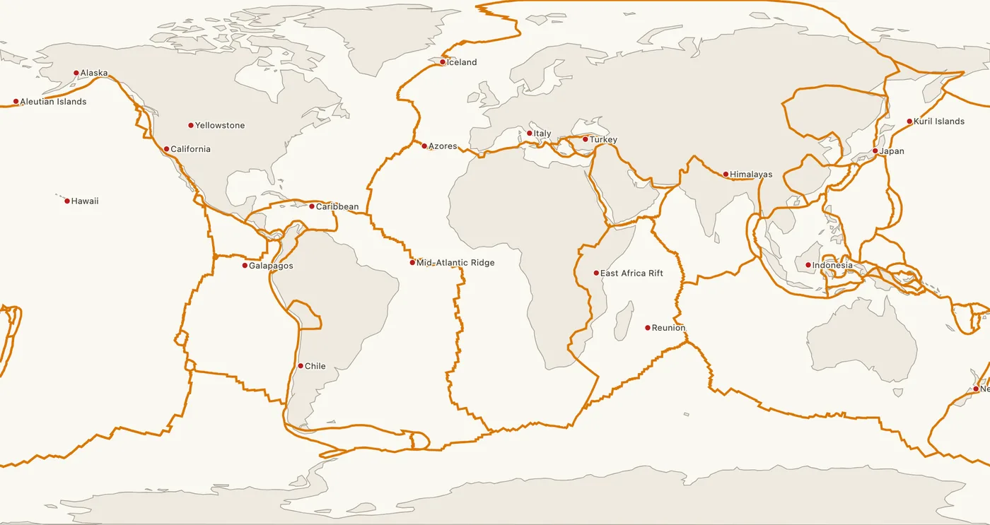
Why are the world's fold mountain systems located along the margins of continents? Bring out the association between the global distribution of fold mountains and the earthquakes and volcanoes.
In short
Fold mountains lie along continental margins because plates converge and compress thick marginal sediments there, and the same convergent belts generate most earthquakes and volcanoes. The Circum-Pacific belt holds about 81 percent of the largest earthquakes, while the Himalaya is seismic but almost volcano-free.
Model answer
Ghissu Editorial · Verified 4 Oct 2026 · 264 words
Convergence at edges
Compression is greatest where plates meet, so the Nazca plate subducting under South America raised the Andes, while shield interiors such as Peninsular India stay stable.
Sediment on margins
Thick sediments collect on continental shelves and in inter-continental seas; the Tethys deposits squeezed between India and Eurasia became the Himalaya and the Alps.
Buoyant crust crumples
Light continental crust resists sinking, so the denser oceanic plate subducts and the continental edge folds.
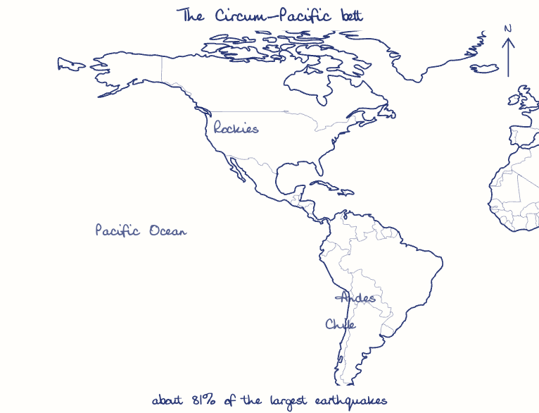
Circum-Pacific belt
The Ring of Fire holds the Andes and Rockies and, as per the USGS, about 81 percent of the largest earthquakes, including Valdivia, Chile (1960, magnitude 9.5), plus most active volcanoes.
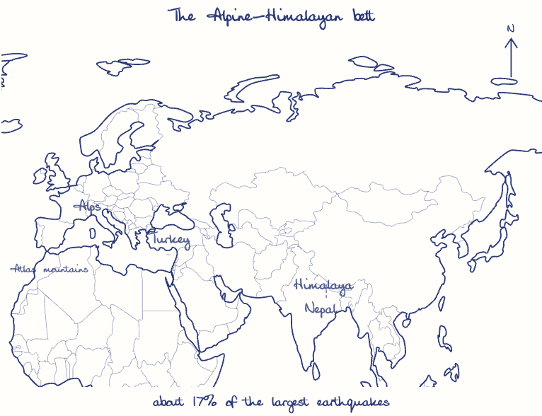
Alpine-Himalayan belt
It accounts for about 17 percent of the largest earthquakes, as in Gorkha, Nepal (2015) and Turkey (2023).
Why volcanoes differ
Melting oceanic slabs feed Andean volcanoes, but the Himalayan collision subducts no oceanic slab today, so it is seismic yet almost free of volcanoes; old ranges like the Aravallis are now quiet.
This model answer is indicative and the model can make mistakes; please verify key facts independently.
Practise this question
1Get the answer sheet
Sized for this question.
2Write your answer
Timed, by hand.
3Get it marked
Your score and what to fix.
This chapter in the exam
The Earth7 questions
Asked in 6 of 14 sittings since 2013
- 2025Discuss how the changes in shape and sizes of continents and ocean basins of the planet take place due to tectonic movements of the crustal masses.
- 2022Discuss the natural resource potentials of Deccan Trap.
All 7 questions, sorted by sub-topic, with model answers and practice.
Question from the official UPSC Civil Services (Main) Examination 2014 paper. Answer written by Ghissu's engine and checked against our editorial standards. Found an error? Tell us and we correct it within 48 hours.