2014 · GS Paper 3 · Q19 · 12 marks
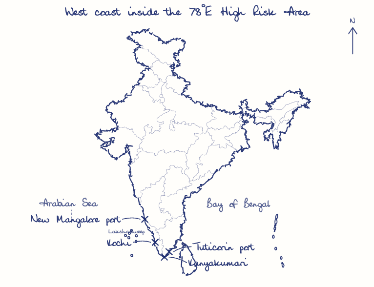
In 2012, the longitudinal marking for high-risk areas for piracy was moved from 65 degrees east to 78 degrees east in the Arabian Sea by the International Maritime Organization. What impact does this have on India's maritime security concerns?
In short
Moving the piracy High Risk Area to 78 degrees East put India's west coast inside a piracy zone, bringing armed private ships, floating armouries and costlier insurance. The Enrica Lexie shooting of two Kerala fishermen in 2012 showed the danger, and India got the line rolled back in 2015.
Model answer
Ghissu Editorial · Verified 4 Oct 2026 · 273 words
Armed ships off the coast
In February 2012, Italian marines guarding the Enrica Lexie shot dead two Kerala fishermen they mistook for pirates.
Weapons at sea
Floating armouries spread, and the Seaman Guard Ohio, detained off Tuticorin in 2013 with weapons aboard, showed the risk.
Jurisdiction disputes
The Enrica Lexie case dragged on until an arbitral tribunal (2020) gave Italy immunity and India compensation.
Economic costs
War-risk insurance premiums rose for ships calling at Kochi, Mangaluru and other west coast ports, raising freight costs for Indian trade.
Naval posture
Operation Island Watch around Lakshadweep in 2011 ended pirate use of the waters around the islands.
Diplomacy
India's pressure got the boundary pulled back to 65 degrees East from December 2015.
Awareness and law
The Information Fusion Centre-IOR (2018) and the Maritime Anti-Piracy Act, 2022 strengthened tracking and prosecution, as when INS Kolkata secured 35 pirates' surrender from MV Ruen in 2024.
This model answer is indicative and the model can make mistakes; please verify key facts independently.
Practise this question
1Get the answer sheet
Sized for this question.
2Write your answer
Timed, by hand.
3Get it marked
Your score and what to fix.
This chapter in the exam
Border Areas12 questions
Asked in 9 of 14 sittings since 2013
- 2026Ladakh is strategically located between China and Pakistan. As a measure to win hearts and minds of locals, discuss the Border Area Development Programmes (BADP) by the Central Government and civic actions by the Army. Also discuss demand of promulgation of provision of the Sixth Schedule of constitution for Ladakh. (Answer in 150 words)
- 2025Why is maritime security vital to protect India's sea trade? Discuss maritime and coastal security challenges and the way forward.
All 12 questions, sorted by sub-topic, with model answers and practice.
Question from the official UPSC Civil Services (Main) Examination 2014 paper. Answer written by Ghissu's engine and checked against our editorial standards. Found an error? Tell us and we correct it within 48 hours.