2019 · GS Paper 3 · Q18 · 15 marks
Disaster preparedness is the first step in any disaster management process. Explain how hazard zonation mapping will help disaster mitigation in the case of landslides.
In short
Hazard zonation mapping helps landslide mitigation by grading terrain into very high to low hazard zones that guide land use, infrastructure alignment, early warning and evacuation planning. The ISRO-NRSC Landslide Atlas of India (2023) finds about 12.6% of India's land prone to landslides.
Model answer
Ghissu Editorial · Verified 4 Oct 2026 · 281 words
Scientific rating
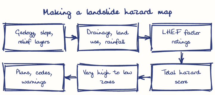
IS 14496 (Part 2) rates lithology, structure, slope, relief, land cover and groundwater through the Landslide Hazard Evaluation Factor scheme.
Graded, nested zones
Ratings sort terrain into very high to very low hazard zones, mapped at 1:50,000 by GSI and needing 1:10,000 for towns.
Land-use regulation
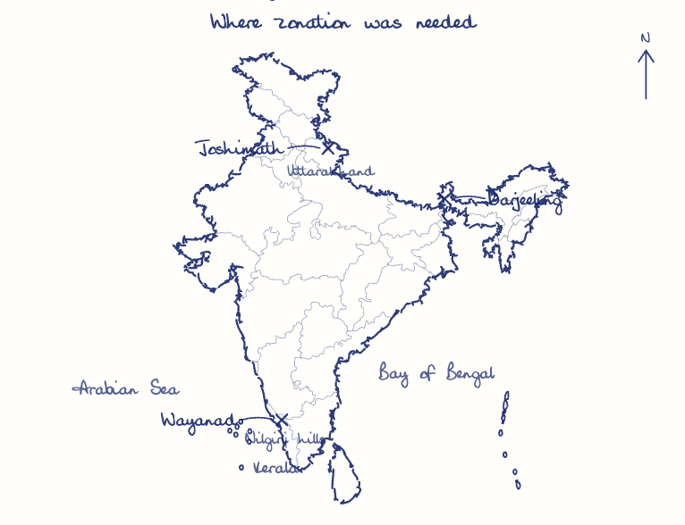
Zones decide where to forbid or restrict building; the Mishra Committee's 1976 Joshimath warning, ignored until the 2023 subsidence, shows the cost of inaction.
Safer infrastructure
Roads, railways and hydropower projects can avoid very high hazard belts or budget for slope protection in advance.
Targeted early warning
Sensors, like Amrita University's network in Munnar, can be concentrated in high hazard zones.
Community preparedness
Red-zone villages get evacuation routes and drills; Wayanad, among the most exposed districts in the atlas, suffered the Mundakkai-Chooralmala debris flow in 2024.
Dynamic and binding maps
Combine zonation with real-time rainfall data, make zones binding in master plans and clearances, and share them with panchayats.
This model answer is indicative and the model can make mistakes; please verify key facts independently.
Practise this question
1Get the answer sheet
Sized for this question.
2Write your answer
Timed, by hand.
3Get it marked
Your score and what to fix.
This chapter in the exam
Landslides & Avalanches2 questions
Asked in 2 of 14 sittings since 2013
Question from the official UPSC Civil Services (Main) Examination 2019 paper. Answer written by Ghissu's engine and checked against our editorial standards. Found an error? Tell us and we correct it within 48 hours.