2026 · GS Paper 1 · Q6 · 10 marks
Discuss the role of aeolian processes in desertification and land degradation.
In short
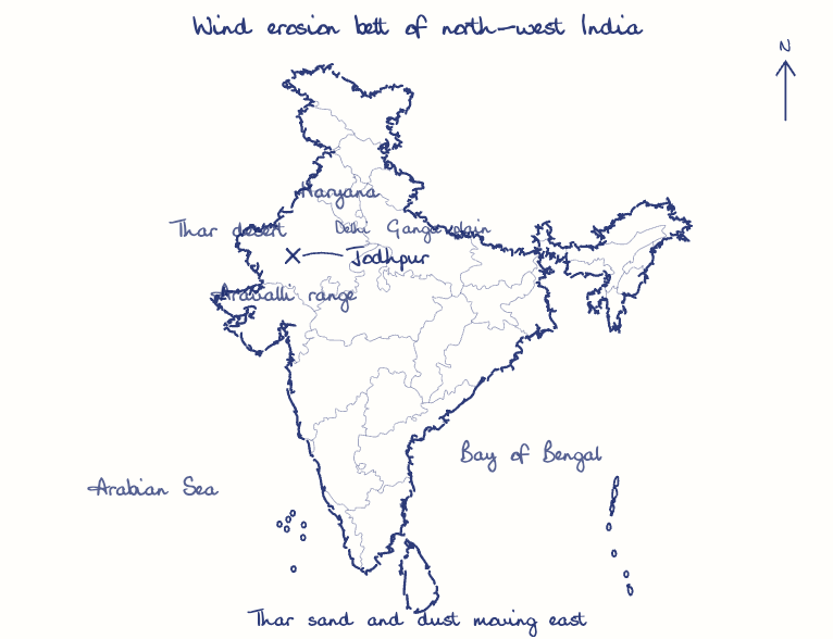
Aeolian processes of deflation, abrasion, dust transport and dune deposition strip fertile topsoil and bury productive land, and a vegetation-wind feedback loop turns that damage into desertification. ISRO's Atlas (2021) found wind erosion on about 5.5% of India's area in 2018-19, mostly in the Thar.
Model answer
Ghissu Editorial · Verified 4 Oct 2026 · 271 words
Deflation
Wind removes fine silt, clay and organic matter that hold nutrients and moisture, leaving a sandy lag and desert pavement.
Abrasion
Saltating sand blasts seedlings and crops at knee height, so young crops in western Rajasthan are often cut down by spring winds.
Dust and dunes
Pre-monsoon dust storms carry Thar topsoil into the Gangetic plain, while mobile barchans bury fields, roads and stretches of the Indira Gandhi Canal.
Self-reinforcing cycle
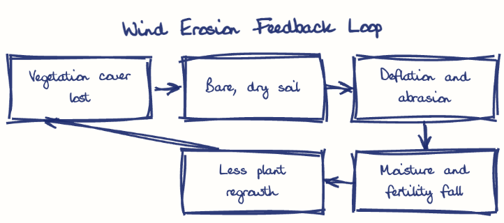
Thinner plant cover exposes soil to wind, which lowers moisture and fertility, so even fewer plants survive.
Human and climate triggers
Overgrazing, ploughing of marginal sandy land and mining breaches in the Aravallis expose soil to wind, while hotter droughts dry it further; the dried Aral Sea bed now generates salt-laden dust storms.
Not only destructive
Wind also builds fertile loess, as on China's Loess Plateau, so it degrades land only when plant cover and soil management fail.
This model answer is indicative and the model can make mistakes; please verify key facts independently.
Practise this question
1Get the answer sheet
Sized for this question.
2Write your answer
Timed, by hand.
3Get it marked
Your score and what to fix.
This chapter in the exam
Landforms5 questions
Asked in 5 of 14 sittings since 2013
- 2023How are the fjords formed? Why do they constitute some of the most picturesque areas of the world?
- 2022Describe the characteristics and types of primary rocks.
All 5 questions, sorted by sub-topic, with model answers and practice.
Question from the official UPSC Civil Services (Main) Examination 2026 paper. Answer written by Ghissu's engine and checked against our editorial standards. Found an error? Tell us and we correct it within 48 hours.