Give a brief account of geographical features of Andhra Pradesh.
In short
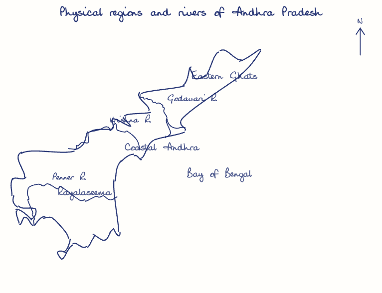
Andhra Pradesh combines the Eastern Ghats, the eastern Deccan Plateau and broad coastal plains, with a tropical monsoon climate, east-flowing rivers like the Godavari and Krishna, and alluvial, red and black soils. Its 974 km coastline is India's second longest, and forests cover about 21.58% of its area.
Model answer
Ghissu Editorial · Verified 4 Oct 2026 · 250 words
River Systems and Irrigation
Godavari and Krishna rivers flow eastward forming fertile deltas; irrigation projects like the Godavari Delta System and Tungabhadra Project are vital for agriculture. Smaller rivers such as Vamsadhara and Penneru also contribute to irrigation and groundwater recharge.
Regional Topography and Climate
Eastern Ghats dominate north and central parts with forests; Deccan Plateau covers west and south with drier terrain; coastal Andhra receives 80% rainfall from southwest monsoon, while Rayalaseema depends on northeast monsoon, causing droughts. Temperature variations also exist, with milder winters along the coast attracting tourism.
Soil and Vegetation Patterns
Alluvial soils in coastal plains support intensive farming; red and black soils in plateau and Rayalaseema suit dryland agriculture; forests cover 21.58%, mainly in Eastern Ghats. Species like teak and Terminalia thrive here, supporting biodiversity and forest-based livelihoods.
Coastal and Forest Conservation
Strengthen coastal zone management and afforestation in Eastern Ghats to preserve biodiversity and sustain fisheries, balancing economic growth with environmental sustainability.
This model answer is indicative and the model can make mistakes; please verify key facts independently.
Practise this question
1Get the answer sheet
Sized for this question.
2Write your answer
Timed, by hand.
3Get it marked
Your score and what to fix.
This chapter in the exam
Physical Features and Resources6 questions
Asked in 3 of 8 sittings since 2008
Most tested: Major landforms and physical features of Andhra Pradesh
- 2025Explain the physical features of India and Andhra Pradesh, especially the major landforms and geographical characteristics.
- 2025Examine the features and importance of the major landforms of Andhra Pradesh with special reference to the Coastal Plains, Eastern Ghats, and Deccan Plateau.
All 6 questions, sorted by sub-topic, with model answers and practice.
Question from the official APPSC Group-I Mains 2020 paper. Answer written by Ghissu's engine and checked against our editorial standards. Found an error? Tell us and we correct it within 48 hours.