Explain the physical features of India and Andhra Pradesh, especially the major landforms and geographical characteristics.
In short
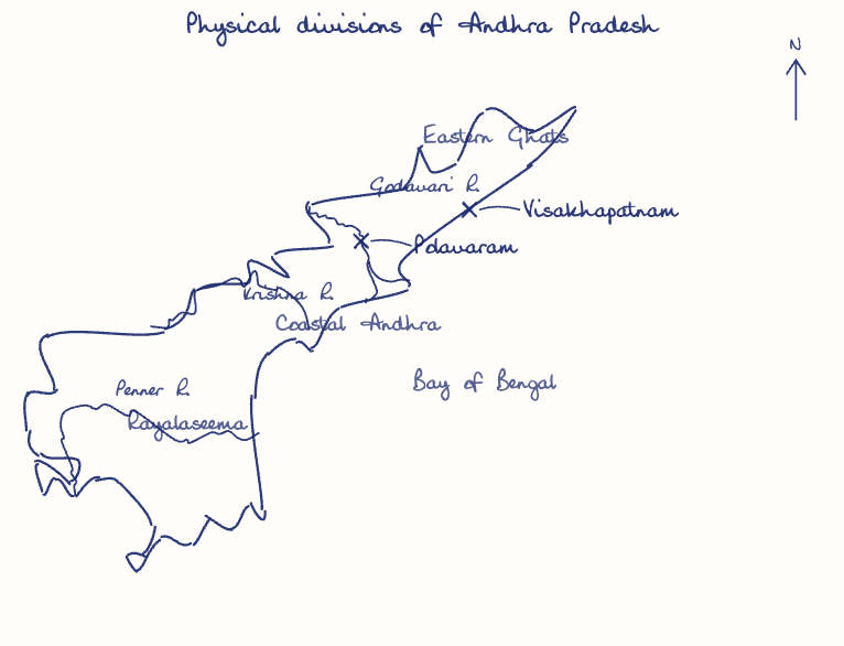
India's major physical features are the Himalayas, the Indo-Gangetic plains, the Peninsular Plateau, and the coastal plains and islands, while Andhra Pradesh comprises the Eastern Ghats, the eastern Deccan Plateau and coastal deltas. Andhra Pradesh has India's second-longest coastline, about 974 km, fringed by the Godavari and Krishna deltas.
Model answer
Ghissu Editorial · Verified 4 Oct 2026 · 259 words
Himalayan Mountain System
The Himalayas, India’s youngest fold mountains, extend 2,400 km with peaks averaging 6,000 meters, formed by the Indian-Eurasian plate collision. They feature V-shaped valleys and fast-flowing rivers crucial for water resources.
Eastern Ghats and Hills
The Eastern Ghats run parallel to the coast with rugged hills in Kurnool and Visakhapatnam, sources of rivers like Gostani and Machkund, featuring waterfalls such as Duduma. These hills also harbor rich biodiversity and forest resources.
Coastal Plains and Deltaic Regions
Andhra Pradesh’s 974 km coastline includes fertile deltas of the Godavari and Krishna rivers, vital for aquaculture and agriculture, supporting cities like Visakhapatnam and Vijayawada. The coastal plains are also important for marine trade and fisheries.
Climatic Zones
India spans six climatic zones; Andhra Pradesh has a tropical climate with 911 mm average rainfall, though Rayalaseema faces droughts. The southwest monsoon dominates, influencing agriculture and water availability.
River Systems and Drainage
Major east-flowing rivers Godavari, Krishna, and Penneru form extensive deltas and support irrigation projects like the Polavaram Project. These rivers are essential for sustaining agriculture and hydroelectric power generation.
This model answer is indicative and the model can make mistakes; please verify key facts independently.
Practise this question
1Get the answer sheet
Sized for this question.
2Write your answer
Timed, by hand.
3Get it marked
Your score and what to fix.
This chapter in the exam
Physical Features and Resources6 questions
Asked in 3 of 8 sittings since 2008
Most tested: Major landforms and physical features of Andhra Pradesh
- 2025Examine the features and importance of the major landforms of Andhra Pradesh with special reference to the Coastal Plains, Eastern Ghats, and Deccan Plateau.
- 2023What are the climatic controls? How do they influence India's climate ?
All 6 questions, sorted by sub-topic, with model answers and practice.
Question from the official APPSC Group-I Mains 2025 paper. Answer written by Ghissu's engine and checked against our editorial standards. Found an error? Tell us and we correct it within 48 hours.