Discuss the vulnerability of Andhra Pradesh to cyclones and floods, highlighting the causes, regional patterns, and impacts.
In short
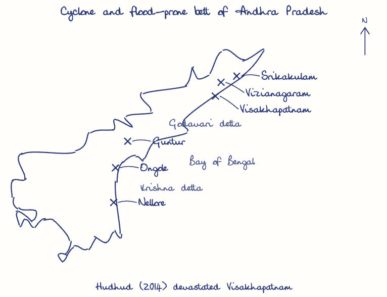
Andhra Pradesh is highly vulnerable to cyclones and floods because of its Bay of Bengal coastline, flat Krishna and Godavari deltas, erratic monsoons and warming seas, with nine coastal districts most exposed to loss of life, crops and infrastructure. Cyclone Hudhud (2014) devastated Visakhapatnam and its neighbouring districts.
Model answer
Ghissu Editorial · Verified 4 Oct 2026 · 263 words
Deltaic and River Basin Flooding
The Krishna and Godavari deltas, with flat terrain and dense river networks, experience frequent flooding; inland districts like East and West Godavari also face inundation during heavy monsoon rains and cyclonic storms.
Monsoon Variability and Climate Change
Erratic monsoon rainfall, especially from the northeast monsoon, leads to sudden heavy rains exacerbating floods. Rising sea surface temperatures due to climate change have increased cyclone frequency and intensity, as seen in recent decades.
Human and Economic Losses
Cyclone Hudhud caused dozens of deaths and extensive damage to Visakhapatnam’s infrastructure; agriculture in delta regions suffers from flood damage, threatening food security and farmers’ livelihoods.
Disaster Management Challenges
Despite early warning systems by the India Meteorological Department reducing casualties, infrastructure resilience remains weak; delays in the Polavaram irrigation project2 hamper effective flood mitigation and rehabilitation efforts.
Enhance Preparedness and Infrastructure
Strengthen forecasting accuracy, community awareness programs, and complete projects like Polavaram to improve resilience against cyclones and floods. Investing in resilient infrastructure and sustainable river basin management is essential.
This model answer is indicative and the model can make mistakes; please verify key facts independently.
Practise this question
1Get the answer sheet
Sized for this question.
2Write your answer
Timed, by hand.
3Get it marked
Your score and what to fix.
This chapter in the exam
Environmental Geography7 questions
Asked in 3 of 8 sittings since 2008
Most tested: Environmental vulnerability and management in Andhra Pradesh, especially drought, pollution control, and disaster impacts.
- 2025Analyse the disaster vulnerability of Rayalaseema region in Andhra Pradesh with respect to droughts. Discuss the socio-economic consequences.
- 2025Assess the role of the Andhra Pradesh Pollution Control Board (APPCB) in post-disaster pollution management.
All 7 questions, sorted by sub-topic, with model answers and practice.
Question from the official APPSC Group-I Mains 2025 paper. Answer written by Ghissu's engine and checked against our editorial standards. Found an error? Tell us and we correct it within 48 hours.