What are the climatic controls? How do they influence India's climate ?
In short
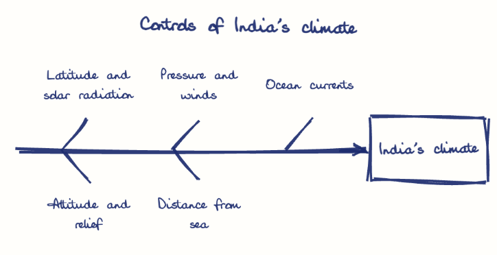
Climatic controls are the factors that shape climate: latitude, altitude and relief, pressure and wind systems, distance from the sea, and ocean currents, which together give India its tropical-to-subtropical monsoon climate. The southwest monsoon supplies about 70-80% of India's rainfall, while the Himalayas block cold Central Asian winds.
Model answer
Ghissu Editorial · Verified 4 Oct 2026 · 275 words
Latitude and Solar Radiation
India’s position between the equator and Tropic of Cancer causes a temperature gradient, producing tropical climates in the south and subtropical in the north. This latitudinal variation also affects the length of day and intensity of solar radiation, shaping seasonal temperature differences.
Altitude and Relief Features
The Himalayas, averaging 6,000 meters, block cold Central Asian winds and influence rainfall; the Eastern and Western Ghats cause orographic rainfall affecting local climates like Andhra Pradesh’s. These relief features create microclimates and influence river patterns, such as the rain shadow effect in the Deccan Plateau.
Pressure and Wind Systems
Monsoon winds driven by land-ocean pressure differences bring 70-80% of rainfall; the northeast monsoon supplies about one-third of Andhra Pradesh’s rainfall, crucial for agriculture in the Godavari and Krishna basins. The Indian Meteorological Department’s data highlights the monsoon’s variability, affecting crop yields and water availability.
Distance from the Sea and Ocean Currents
Coastal regions like Visakhapatnam experience moderate temperatures and high humidity, supporting aquaculture and horticulture, while interior areas like Rayalaseema face drought due to continentality. Warming Indian Ocean currents increase cyclone frequency and intensity, exemplified by cyclones Hudhud (2014) and Titli (2018) in Andhra Pradesh, causing severe damage and highlighting climate vulnerability.
This model answer is indicative and the model can make mistakes; please verify key facts independently.
Practise this question
1Get the answer sheet
Sized for this question.
2Write your answer
Timed, by hand.
3Get it marked
Your score and what to fix.
This chapter in the exam
Physical Features and Resources6 questions
Asked in 3 of 8 sittings since 2008
Most tested: Major landforms and physical features of Andhra Pradesh
- 2025Explain the physical features of India and Andhra Pradesh, especially the major landforms and geographical characteristics.
- 2025Examine the features and importance of the major landforms of Andhra Pradesh with special reference to the Coastal Plains, Eastern Ghats, and Deccan Plateau.
All 6 questions, sorted by sub-topic, with model answers and practice.
Question from the official APPSC Group-I Mains 2023 paper. Answer written by Ghissu's engine and checked against our editorial standards. Found an error? Tell us and we correct it within 48 hours.