In 2016, "Pradhan Mantri Fasal Bima Yojana (PMFBY)" was launched by Govt. of India as an insurance services for farmers for their yield. Describe the role of space technology used in this scheme.
In short
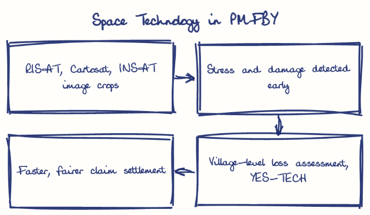
Space technology lets PMFBY monitor crops, detect damage and assess losses at the village level through ISRO satellites like RISAT and Cartosat, replacing slow, error-prone crop cutting surveys. YES-TECH, satellite-based yield estimation from Kharif 2023, speeds claims, and non-loanee applications rose from 20 lakh (2014-15) to 522 lakh (2024-25).
Model answer
Ghissu Editorial · Verified 4 Oct 2026 · 250 words
Reducing Manual Surveys
Satellite data minimizes dependence on crop cutting experiments, improving transparency and efficiency in loss assessment while reducing delays and errors in claim processing.
Geospatial Analytics
Platforms like YES-TECH1 use satellite data for yield estimation and damage mapping at the Gram Panchayat level, expediting claims and ensuring localized loss assessment.
Increased Coverage and Inclusion
Farmer enrolment has risen significantly, with non-loanee farmers’ applications growing from 20 lakh (2014-15) to 522 lakh (2024-25), broadening scheme reach and ensuring credit flow beyond formal loan access.
Transparency and Fraud Reduction
Objective satellite imagery reduces disputes and fraudulent claims, strengthening scheme credibility and financial viability.
Improved Agricultural Planning
Space data supports policymakers and farmers in making informed decisions on crop diversification and irrigation, promoting sustainable agriculture in Telangana and other regions.
Expand Data Integration
Enhance ISRO-agriculture collaboration in Telangana for higher resolution and more frequent satellite monitoring to improve precision in crop loss assessment.
Capacity Building
Train insurance companies, government officials, and farmers to effectively use space-based tools, ensuring better implementation and faster claim settlements.
This model answer is indicative and the model can make mistakes; please verify key facts independently.
Practise this question
1Get the answer sheet
Sized for this question.
2Write your answer
Timed, by hand.
3Get it marked
Your score and what to fix.
This chapter in the exam
Space applications, disasters and climate4 questions
Asked in 2 of 2 sittings since 2016
Most tested: Space technology for governance applications, especially land records and agricultural insurance.
- 2024The "Ministry of Panchayti Raj" of Govt. of India has launched "SVAMITVA" scheme for mapping of land records. Elaborate the role of space technology to help in accomplishing the goal of the scheme.
- 2024What is Biodiversity? How does Climate Change affect biodiversity? Highlight the various conservation measures taken by the Government of India to protect biodiversity.
All 4 questions, sorted by sub-topic, with model answers and practice.
Question from the official TGPSC Group-I Mains 2024 paper. Answer written by Ghissu's engine and checked against our editorial standards. Found an error? Tell us and we correct it within 48 hours.