2013 · GS Paper 1 · Q12 · 10 marks
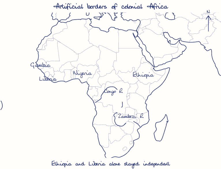
Africa was chopped into States artificially created by accidents of European competition. Analyze.
In short
Africa's states were largely artificial products of European rivalry, drawn on maps after the Berlin Conference of 1884-85 that split peoples and forced unions, though strategy and African agency also shaped them. Lugard's 1914 amalgamation of Nigeria, which led towards the Biafran war, shows the cost.
Model answer
Ghissu Editorial · Verified 4 Oct 2026 · 272 words
Diplomacy without Africans
The Berlin Conference seated no African, and its "effective occupation" rule froze frontiers wherever rival expeditions met.
Bargained corridors
The Caprivi Strip (1890) gave Germany access to the Zambezi, and the Gambia survives as an enclave inside Senegal from an Anglo-French split of one valley.
Divided and forced peoples
The Somali were split among five territories, feeding the Ogaden War of 1977-78, while Lugard's 1914 amalgamation of Nigeria set up the Biafran war of 1967-70.
Calculated, not accidental
Lines were often drawn to secure rivers, ports and railways, and Robinson and Gallagher link the scramble to deliberate responses to crises such as Egypt in 1882.
African agency
Menelik II's victory at Adwa (1896) fixed Ethiopia's frontiers, and polities such as Morocco and Lesotho survived intact.
African endorsement
The OAU's Cairo resolution of 1964 chose to keep the colonial borders rather than risk redrawing them.
This model answer is indicative and the model can make mistakes; please verify key facts independently.
Practise this question
1Get the answer sheet
Sized for this question.
2Write your answer
Timed, by hand.
3Get it marked
Your score and what to fix.
This chapter in the exam
Colonization2 questions
Asked in 2 of 14 sittings since 2013
Question from the official UPSC Civil Services (Main) Examination 2013 paper. Answer written by Ghissu's engine and checked against our editorial standards. Found an error? Tell us and we correct it within 48 hours.