2013 · GS Paper 1 · Q19(a) · 5 marks
What do you understand by the theory of 'continental drift'? Discuss the prominent evidences in its support.
In short
Wegener's continental drift theory holds that all continents once formed one supercontinent, Pangaea, which split into Laurasia and Gondwanaland and drifted apart. Its strongest evidence is the matching of rocks, Gondwana tillite and Mesosaurus and Glossopteris fossils across the now separated southern continents.
Model answer
Ghissu Editorial · Verified 4 Oct 2026 · 270 words
One supercontinent
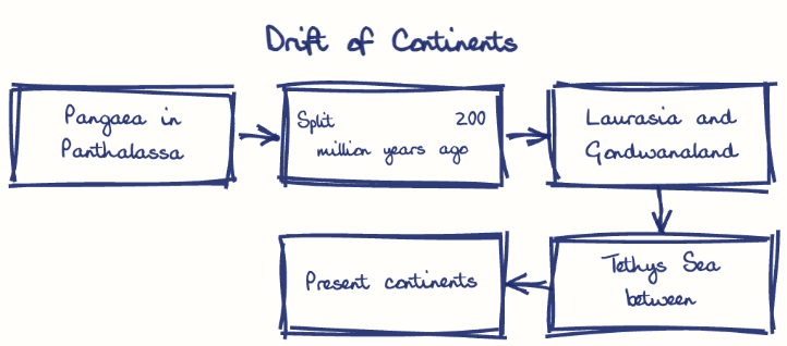
All landmasses once formed Pangaea, surrounded by a single ocean, Panthalassa.
Break-up
Around 200 million years ago Pangaea split into Laurasia and Gondwanaland, separated by the Tethys Sea, which later broke into today's continents.
Forces and flaw
He credited the drift to a pole-fleeing force and to the tidal pull of the Sun and Moon, forces too weak to move continents, so the theory waited for sea-floor spreading to explain the mechanism.
Jigsaw fit
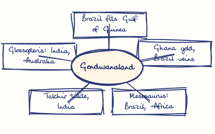
Brazil's bulge fits the Gulf of Guinea, and Bullard's 1964 computer fit along the 1,000-fathom line was nearly perfect.
Matching rocks and placers
2,000 million-year-old rocks of coastal Brazil match those of western Africa, and Ghana's gold placers come from veins that lie in Brazil.
Tillite and old climates
Gondwana tillite, like India's Talchir beds, recurs in six southern landmasses, and Antarctic coal shows it once lay in warm latitudes.
Fossil distribution
Mesosaurus occurs only in South Africa and Brazil, and the Glossopteris flora spans India, Africa, Australia, Antarctica and South America.
This model answer is indicative and the model can make mistakes; please verify key facts independently.
Practise this question
1Get the answer sheet
Sized for this question.
2Write your answer
Timed, by hand.
3Get it marked
Your score and what to fix.
This chapter in the exam
The Earth7 questions
Asked in 6 of 14 sittings since 2013
- 2025Discuss how the changes in shape and sizes of continents and ocean basins of the planet take place due to tectonic movements of the crustal masses.
- 2022Discuss the natural resource potentials of Deccan Trap.
All 7 questions, sorted by sub-topic, with model answers and practice.
Question from the official UPSC Civil Services (Main) Examination 2013 paper. Answer written by Ghissu's engine and checked against our editorial standards. Found an error? Tell us and we correct it within 48 hours.