2017 · GS Paper 3 · Q18 · 15 marks
On December 2004, tsunami brought havoc on fourteen countries including India. Discuss the factors responsible for occurrence of tsunami and its effects on life and economy. In the light of guidelines of NDMA (2010) describe the mechanisms for preparedness to reduce the risk during such events.
In short
Tsunamis arise mainly from shallow undersea megathrust earthquakes, magnified by shallow shelves and lost mangroves, and the 2004 waves devastated lives, fisheries and coastal land. The NDMA's 2010 guidelines rest on the INCOIS early warning centre, inundation mapping, safe structures, bio-shields and community drills.
Model answer
Ghissu Editorial · Verified 4 Oct 2026 · 291 words
Subduction earthquakes
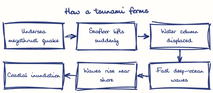
A shallow quake with vertical seafloor movement, as along the Sunda-Andaman trench in 2004, displaces the water column.
Other triggers
Submarine landslides and volcanic eruptions such as Hunga Tonga (2022) can also generate tsunamis.
Coastal amplifiers
Shallow shelves, flat coasts and lost mangroves, as at Nagapattinam, magnify the run-up.
Loss of life
Nagapattinam alone lost about 6,000 people, and Andaman villages were washed away.
Livelihoods and land
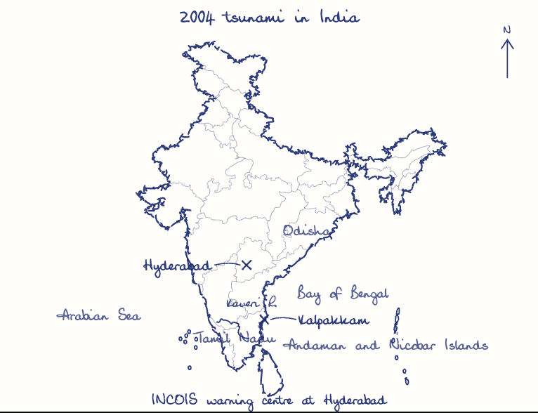
Fishing boats and nets were wrecked for months, Cauvery delta farmland was salinised, the Car Nicobar air base was damaged and the Kalpakkam nuclear plant shut down.
Early warning
INCOIS's Tsunami Early Warning Centre (2007) uses seismic stations, bottom pressure recorders and tide gauges.
Mapping and structures
Inundation maps, Coastal Regulation Zone enforcement and tsunami-resistant lifeline buildings guide safe land use.
Bio-shields and drills
Mangroves, as at Pichavaram, and community evacuation drills protect people.
Tsunami Ready coasts
Extend Odisha's Venkatraipur and Noliasahi model (UNESCO-IOC, 2020) to every coast, carry alerts to fishers by cell broadcast, and rebuild buffers under the MISHTI mangrove mission.
This model answer is indicative and the model can make mistakes; please verify key facts independently.
Practise this question
1Get the answer sheet
Sized for this question.
2Write your answer
Timed, by hand.
3Get it marked
Your score and what to fix.
This chapter in the exam
Earthquakes & Tsunamis3 questions
Asked in 3 of 14 sittings since 2013
- 2021Discuss about the vulnerability of India to earthquake related hazards. Give examples including the salient features of major disasters caused by earthquakes in different parts of India during the last three decades.
- 2015The frequency of earthquakes appears to have increased in the Indian subcontinent. However, India's preparedness for mitigating their impact has significant gaps. Discuss various aspects.
Question from the official UPSC Civil Services (Main) Examination 2017 paper. Answer written by Ghissu's engine and checked against our editorial standards. Found an error? Tell us and we correct it within 48 hours.