2021 · GS Paper 3 · Q8 · 10 marks
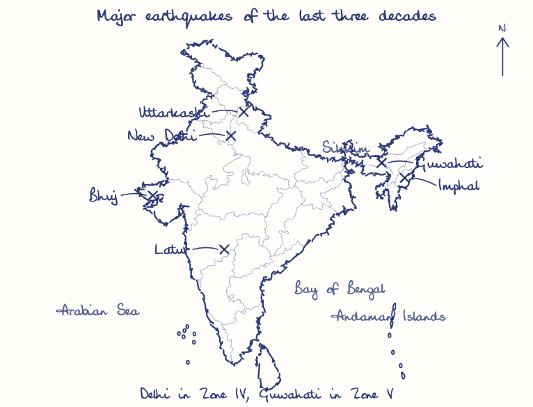
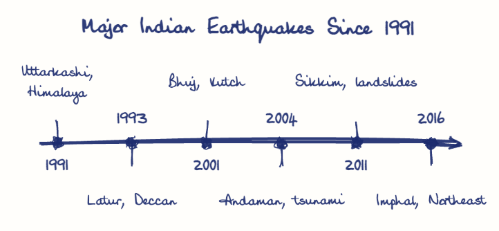
Discuss about the vulnerability of India to earthquake related hazards. Give examples including the salient features of major disasters caused by earthquakes in different parts of India during the last three decades.
In short
India is highly vulnerable to earthquakes because the Indian plate's push into Eurasia, peninsular rifts and the Andaman subduction zone put about 59% of its land at risk, while non-engineered buildings magnify losses. Latur (1993), Bhuj (2001), the 2004 tsunami and Sikkim (2011) show the varied regional pattern.
Model answer
Ghissu Editorial · Verified 4 Oct 2026 · 290 words
Tectonic setting
The Himalayan collision front, the Andaman subduction zone and peninsular rifts such as Kutch and Koyna leave no region fully safe.
Seismic zoning
BIS places about 11% of India in Zone V, 18% in Zone IV and 30% in Zone III, and its 2025 code adds a Zone VI for the Himalayan arc.
Built vulnerability
Non-engineered masonry, weak code enforcement and dense cities like Delhi (Zone IV) and Guwahati (Zone V) multiply exposure.
Secondary hazards
Alluvium liquefies, slopes fail and undersea ruptures send tsunamis.
Latur, 1993
A magnitude 6.2 night tremor in the "stable" Deccan killed nearly 10,000 as stone-and-mud roofs collapsed.
Bhuj, 2001
The magnitude 7.7 Kutch quake killed about 20,000, toppled Ahmedabad's high-rises and produced the Gujarat State Disaster Management Act 2003.
Indian Ocean, 2004
The magnitude 9.1 rupture's tsunami killed over 10,000 in India, prompting the INCOIS warning centre (2007).
Sikkim, 2011
The magnitude 6.9 quake did most damage through landslides that isolated villages.
This model answer is indicative and the model can make mistakes; please verify key facts independently.
Practise this question
1Get the answer sheet
Sized for this question.
2Write your answer
Timed, by hand.
3Get it marked
Your score and what to fix.
This chapter in the exam
Earthquakes & Tsunamis3 questions
Asked in 3 of 14 sittings since 2013
- 2017On December 2004, tsunami brought havoc on fourteen countries including India. Discuss the factors responsible for occurrence of tsunami and its effects on life and economy. In the light of guidelines of NDMA (2010) describe the mechanisms for preparedness to reduce the risk during such events.
- 2015The frequency of earthquakes appears to have increased in the Indian subcontinent. However, India's preparedness for mitigating their impact has significant gaps. Discuss various aspects.
Question from the official UPSC Civil Services (Main) Examination 2021 paper. Answer written by Ghissu's engine and checked against our editorial standards. Found an error? Tell us and we correct it within 48 hours.