2020 · GS Paper 1 · Q15 · 15 marks
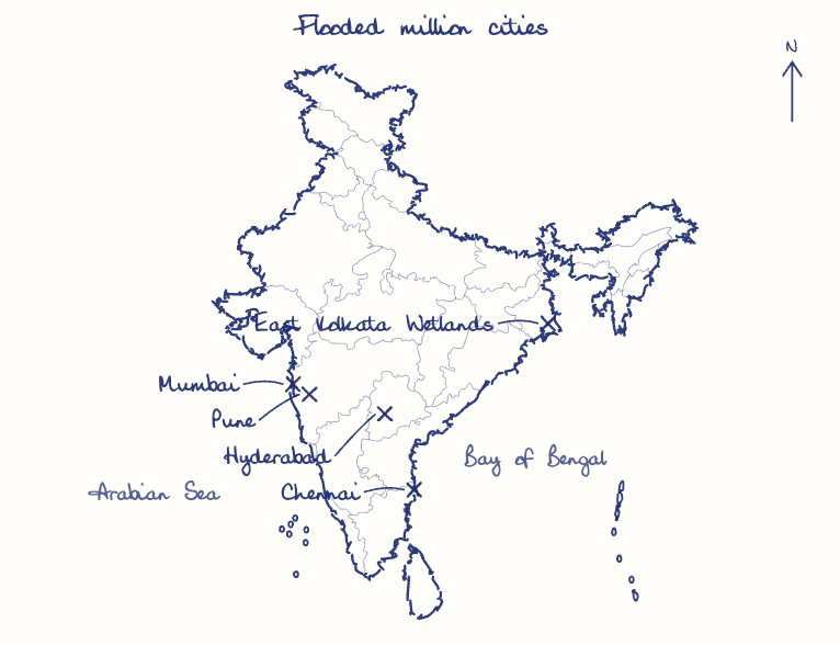
Account for the huge flooding of million cities in India including the smart ones like Hyderabad and Pune. Suggest lasting remedial measures.
In short
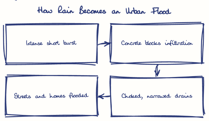
Million-plus Indian cities, including smart ones like Hyderabad and Pune, flood because intense rain meets encroached lakes and streams, concrete sprawl, outdated choked drains and fragmented governance; lasting remedies restore water bodies, adopt sponge-city design and modernise drainage. Hyderabad's built-up cover rose 41% between 2000 and 2015.
Model answer
Ghissu Editorial · Verified 4 Oct 2026 · 288 words
Intense rainfall
Short, extreme bursts are more frequent in a warming climate, as in Mumbai's 944 mm at Santacruz on 26 July 2005.
Lost lakes and streams
Hyderabad's tanks and nalas were built over, as the Kirloskar Committee warned, and Pune's Ambil Odha was narrowed before its 2019 flood.
Concrete and old drains
Hyderabad's built-up cover rose 41% in 2000-2015 (WRI India), while Mumbai's drains were designed for only 25 mm an hour.
Gadgets over drains
The Smart Cities Mission funded sensors and command centres, not natural drainage, so Pune, a Mission city, still flooded, as did tech-hub Hyderabad.
Fragmented control
Lakes, drains and land use sit with different agencies, colonies stand inside lake beds, and tides or swollen rivers block outfalls.
Blue network and sponge design
De-encroach lakes and flood plains, protect wetlands like East Kolkata, and mandate permeable paving and retention ponds.
Funding and warning
Redesign drains under NDMA's Urban Flood Risk Management Programme for seven metros (2023), and scale up IFLOWS-type warning under one metropolitan flood authority.
This model answer is indicative and the model can make mistakes; please verify key facts independently.
Practise this question
1Get the answer sheet
Sized for this question.
2Write your answer
Timed, by hand.
3Get it marked
Your score and what to fix.
This chapter in the exam
Natural Hazards and Disasters6 questions
Asked in 5 of 14 sittings since 2013
- 2023Comment on the resource potentials of the long coastline of India and highlight the status of natural hazard preparedness in these areas.
- 2021Differentiate the causes of landslides in the Himalayan region and Western Ghats.
All 6 questions, sorted by sub-topic, with model answers and practice.
Question from the official UPSC Civil Services (Main) Examination 2020 paper. Answer written by Ghissu's engine and checked against our editorial standards. Found an error? Tell us and we correct it within 48 hours.