2021 · GS Paper 1 · Q4 · 10 marks
Differentiate the causes of landslides in the Himalayan region and Western Ghats.
In short
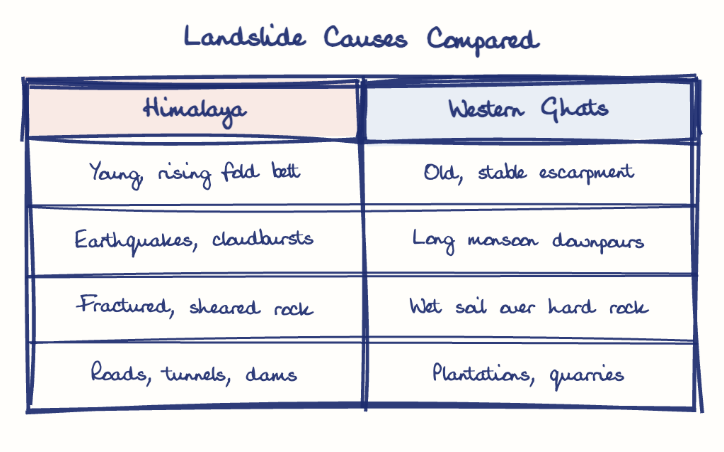
Himalayan landslides stem from a young, tectonically active fold belt with fractured rock, earthquakes, cloudbursts and heavy infrastructure, while Western Ghats landslides stem from monsoon saturation of lateritic soil over hard rock, plantations and quarrying. The Wayanad debris flow of July 2024 killed more than 200 people.
Model answer
Ghissu Editorial · Verified 4 Oct 2026 · 300 words
Tectonics
The young, rising Himalaya is crushed along thrusts such as the Main Central Thrust and lies in Seismic Zones IV and V; the Ghats are an old, stable escarpment where quakes rarely trigger slides.
Trigger and material
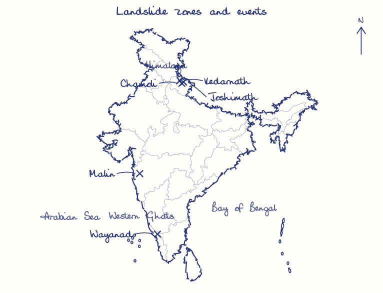
Himalayan slides follow cloudbursts and glacial floods, as in Kedarnath (2013) and Chamoli (2021); in the Ghats, days of monsoon rain saturate lateritic soil, which slips over hard basalt as a debris flow.
Relief
Himalayan rivers such as the Alaknanda undercut gorge slopes, while the steep western scarp of the Ghats faces the monsoon head on.
Himalayan infrastructure
Char Dham road cutting, hydropower tunnels and unchecked building load slopes, as the Joshimath subsidence of 2023 revealed.
Ghats land-use change
Tea, cardamom and rubber plantations replacing forests, and quarrying, which the Gadgil Committee (2011) sought to curb, loosen hillsides.
Settlement on slopes
Villages built on old debris-flow paths turn slides into disasters, as at Malin (2014) and Wayanad, where the July 2024 debris flow killed more than 200 people.
This model answer is indicative and the model can make mistakes; please verify key facts independently.
Practise this question
1Get the answer sheet
Sized for this question.
2Write your answer
Timed, by hand.
3Get it marked
Your score and what to fix.
This chapter in the exam
Natural Hazards and Disasters6 questions
Asked in 5 of 14 sittings since 2013
- 2023Comment on the resource potentials of the long coastline of India and highlight the status of natural hazard preparedness in these areas.
- 2020Account for the huge flooding of million cities in India including the smart ones like Hyderabad and Pune. Suggest lasting remedial measures.
All 6 questions, sorted by sub-topic, with model answers and practice.
Question from the official UPSC Civil Services (Main) Examination 2021 paper. Answer written by Ghissu's engine and checked against our editorial standards. Found an error? Tell us and we correct it within 48 hours.