2020 · GS Paper 1 · Q6 · 10 marks
How will the melting of Himalayan glaciers have a far-reaching impact on the water resources of India?
In short
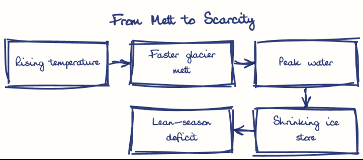
Melting Himalayan glaciers will first raise flows and hazards such as glacial lake outbursts, then shrink the dry-season water India's rivers, aquifers and farms depend on. ICIMOD (2019) projects a third of the region's glaciers lost by 2100 even at 1.5°C of warming.
Model answer
Ghissu Editorial · Verified 4 Oct 2026 · 271 words
Deceptive rise in flows
Glacier melt supplies about 25-30% of melt-season flow (MoEFCC, 2009), and faster melt briefly swells rivers, masking the coming decline.
Outburst floods
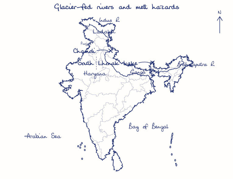
Expanding moraine-dammed lakes can burst suddenly, as South Lhonak lake did in October 2023, washing away the Teesta III dam at Chungthang in Sikkim.
Silt and slope failure
The 2021 Chamoli rock-and-ice avalanche wrecked two hydro projects, and heavier silt from meltwater fills reservoirs and wears turbines.
Indus most exposed
The Indus relies far more on ice melt than the monsoon-fed Ganga, so Ladakh, Punjab and Haryana will feel the decline first.
Lean-season and recharge loss
After peak water, April-June flows for rabi crops and cities shrink, and recharge of Indo-Gangetic aquifers and mountain springs weakens, worsening groundwater over-extraction in the plains.
Transboundary strain
Scarcer flows raise the stakes over Chinese dams on the Yarlung Tsangpo and over the Indus Waters Treaty, which India placed in abeyance in 2025.
This model answer is indicative and the model can make mistakes; please verify key facts independently.
Practise this question
1Get the answer sheet
Sized for this question.
2Write your answer
Timed, by hand.
3Get it marked
Your score and what to fix.
This chapter in the exam
Resources and planning38 questions
Asked in 14 of 14 sittings since 2013
- 2026"Water resources are both an asset and a source of conflict in South Asia." Examine this statement giving examples.
- 2026Analyze the role of satellite-based technologies in achieving climate-smart agriculture and food security in India.
All 38 questions, sorted by sub-topic, with model answers and practice.
Question from the official UPSC Civil Services (Main) Examination 2020 paper. Answer written by Ghissu's engine and checked against our editorial standards. Found an error? Tell us and we correct it within 48 hours.