2026 · GS Paper 1 · Q15 · 15 marks
Analyze the role of satellite-based technologies in achieving climate-smart agriculture and food security in India.
In short
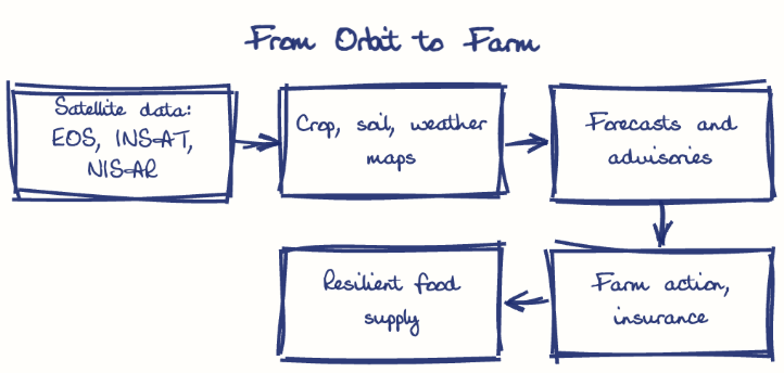
Satellite technologies drive climate-smart agriculture and food security in India through weather advisories, drought detection, crop forecasting and faster insurance, though cloud cover and tiny plots limit accuracy. YES-TECH (2023) gives satellite-based yield estimates at least 30% weight in PMFBY for rice and wheat.
Model answer
Ghissu Editorial · Verified 4 Oct 2026 · 281 words
Weather advisories
INSAT-3D series imagery feeds IMD's Gramin Krishi Mausam Sewa, guiding sowing and irrigation ahead of heatwaves and dry spells.
Soil and water mapping
Krishi-DSS (2024) and Bhuvan combine soil-moisture, cropping and water-body layers, while Geo-MGNREGA geotags farm ponds for watershed planning.
Drought detection
NADAMS uses vegetation indices to flag agricultural drought, now part of drought declaration under the 2016 Drought Manual.
Mitigation tracking
IARI's CREAMS lab tracks paddy-residue fires by satellite in Punjab and Haryana, guiding action that cuts emissions.
Production forecasting
FASAL and CHAMAN give pre-harvest crop estimates for planning buffer stocks and trade.
Faster insurance
YES-TECH (2023) gives satellite-based yields at least 30% weight in PMFBY for rice and wheat.
Persistent gaps
Monsoon cloud blinds optical sensors, and 68.45% of holdings below one hectare (Agriculture Census 2015-16) are often too small for coarse-resolution sensors.
Radar and integration
Feed NISAR (2025) radar data into Krishi-DSS and link it with the AgriStack crop survey for plot-level advisories, credit and insurance.
This model answer is indicative and the model can make mistakes; please verify key facts independently.
Practise this question
1Get the answer sheet
Sized for this question.
2Write your answer
Timed, by hand.
3Get it marked
Your score and what to fix.
This chapter in the exam
Resources and planning38 questions
Asked in 14 of 14 sittings since 2013
- 2026"Water resources are both an asset and a source of conflict in South Asia." Examine this statement giving examples.
- 2026Analyze the major drivers of human-induced land-use changes in India and their geographical consequences.
All 38 questions, sorted by sub-topic, with model answers and practice.
Question from the official UPSC Civil Services (Main) Examination 2026 paper. Answer written by Ghissu's engine and checked against our editorial standards. Found an error? Tell us and we correct it within 48 hours.