2020 · GS Paper 1 · Q14 · 15 marks
The interlinking of rivers can provide viable solutions to the multi-dimensional inter-related problems of droughts, floods and interrupted navigation. Critically examine.
In short
River interlinking can relieve chronically dry basins and offers some flood and navigation gains, but it cannot solve all three problems together because surplus and deficit often coincide and its ecological and social costs are high. The Ken-Betwa link aims to irrigate 10.62 lakh hectares in Bundelkhand.
Model answer
Ghissu Editorial · Verified 4 Oct 2026 · 264 words
Drought proofing
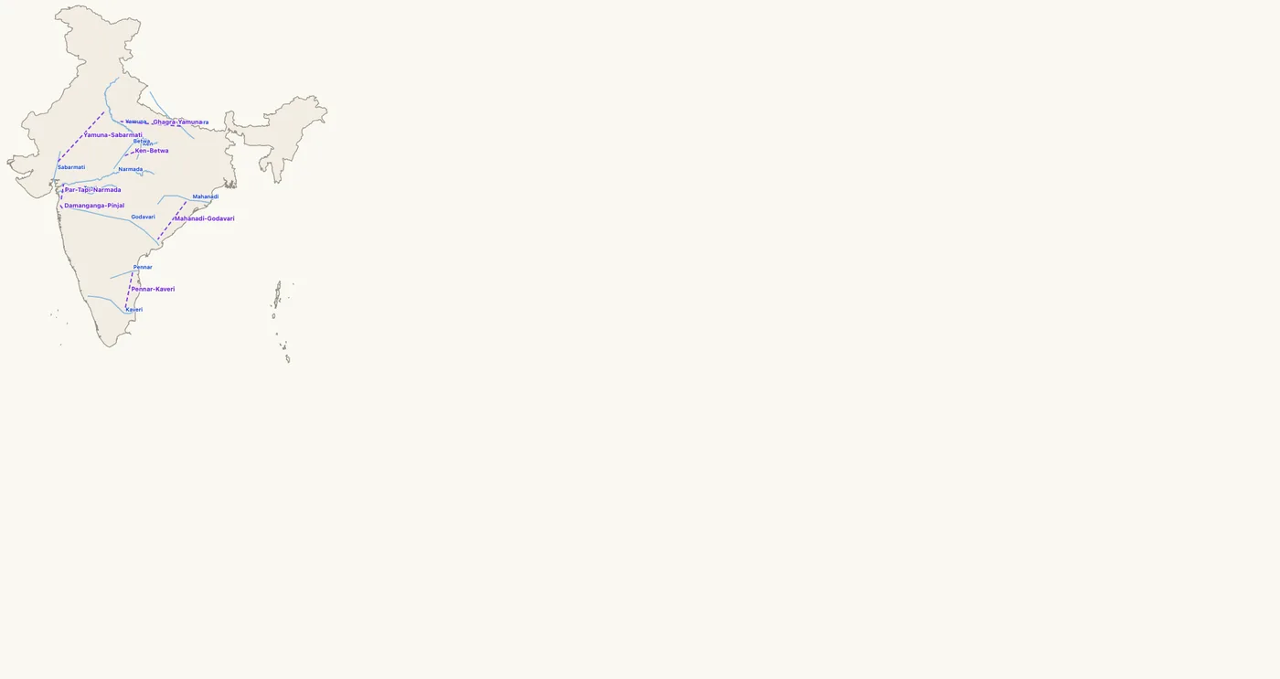
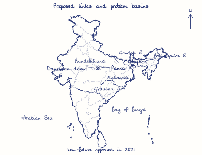
The Ken-Betwa link (₹44,605 crore, approved 2021) aims to irrigate 10.62 lakh hectares in Bundelkhand, and the Pattiseema lift has fed Godavari water to the Krishna delta since 2015-16.
Floods and navigation
Diverting peak flows of the Kosi and Brahmaputra and regulated lean-season releases could ease floods and support the 111 national waterways of 2016.
Questionable surplus
Donor and receiving basins flood in the same weeks, canals carry a small fraction of a flood peak, and Odisha disputes any Mahanadi surplus.
Ecological and social cost
Ken-Betwa submerges part of the Panna Tiger Reserve, and the Par-Tapi-Narmada link was put on hold in 2022 after tribal protests.
Federal, fiscal and foreign hurdles
Water is a State subject, the plan cost about ₹5.6 lakh crore at 2002 prices, and Himalayan links need Bhutan and Bangladesh.
Selective and decentralised
Independent link-by-link appraisal, watershed and recharge works under Catch the Rain, and basin-wide flood zoning should come first.
This model answer is indicative and the model can make mistakes; please verify key facts independently.
Practise this question
1Get the answer sheet
Sized for this question.
2Write your answer
Timed, by hand.
3Get it marked
Your score and what to fix.
This chapter in the exam
Resources and planning38 questions
Asked in 14 of 14 sittings since 2013
- 2026"Water resources are both an asset and a source of conflict in South Asia." Examine this statement giving examples.
- 2026Analyze the role of satellite-based technologies in achieving climate-smart agriculture and food security in India.
All 38 questions, sorted by sub-topic, with model answers and practice.
Question from the official UPSC Civil Services (Main) Examination 2020 paper. Answer written by Ghissu's engine and checked against our editorial standards. Found an error? Tell us and we correct it within 48 hours.