2021 · GS Paper 1 · Q14 · 15 marks
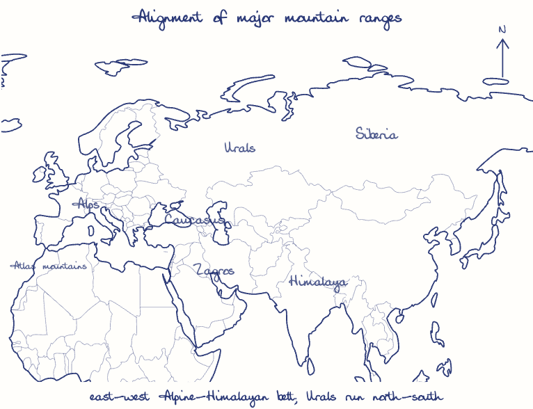
Briefly mention the alignment of major mountain ranges of the world and explain their impact on local weather conditions, with examples.
In short
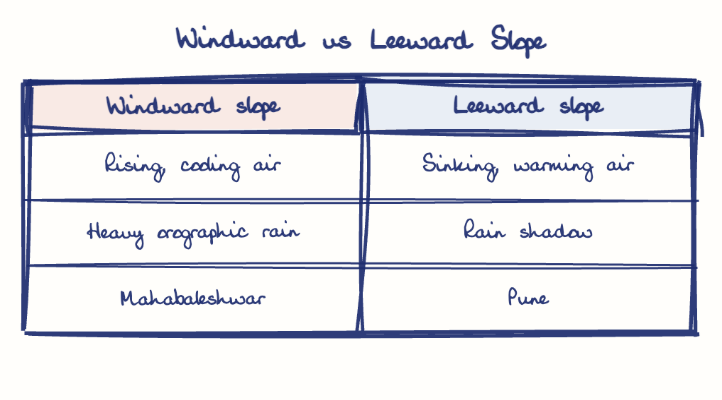
Major ranges run either east-west, like the Alpine-Himalayan belt, or north-south, like the Rockies, Andes and Western Ghats, and their angle to the winds shapes rainfall, cold barriers and local winds. Windward Mahabaleshwar receives over 5,000 mm of rain while leeward Pune lies in a rain shadow.
Model answer
Ghissu Editorial · Verified 4 Oct 2026 · 290 words
East-west Alpine-Himalayan belt
The Atlas, Alps, Caucasus, Zagros and Himalaya run east to west along the old Tethys suture.
North-south ranges
The Rockies and Andes line the western Americas, and the Urals, Great Dividing Range and India's Western Ghats also run broadly north-south, while the Aravallis trend north-east to south-west.
Orographic rain and rain shadow
Windward slopes get heavy rain and leeward slopes stay dry, so Mahabaleshwar receives over 5,000 mm while nearby Pune gets under 1,000 mm.
Cold barrier
The Himalaya blocks Siberian air from the northern plains, whereas North America's open north-south corridor lets Arctic and Gulf air clash, breeding tornadoes.
Parallel alignment
The Aravallis run parallel to the monsoon, fail to lift it, and leave western Rajasthan dry.
Local winds
Descending Chinook winds on the Rockies and the Foehn in the Alps warm leeward slopes sharply, the Chinook by over 20 degrees Celsius within hours, and valley inversions bring fog and frost to Kashmir.
Mountain forecasting
Himalayan Doppler radars can track cloudburst-producing convection like Kedarnath 2013.
Rain-shadow planning
Watershed development and drought-resilient crops suit leeward Marathwada and interior Karnataka.
This model answer is indicative and the model can make mistakes; please verify key facts independently.
Practise this question
1Get the answer sheet
Sized for this question.
2Write your answer
Timed, by hand.
3Get it marked
Your score and what to fix.
This chapter in the exam
Landforms5 questions
Asked in 5 of 14 sittings since 2013
- 2026Discuss the role of aeolian processes in desertification and land degradation.
- 2023How are the fjords formed? Why do they constitute some of the most picturesque areas of the world?
All 5 questions, sorted by sub-topic, with model answers and practice.
Question from the official UPSC Civil Services (Main) Examination 2021 paper. Answer written by Ghissu's engine and checked against our editorial standards. Found an error? Tell us and we correct it within 48 hours.