2023 · GS Paper 3 · Q18 · 15 marks
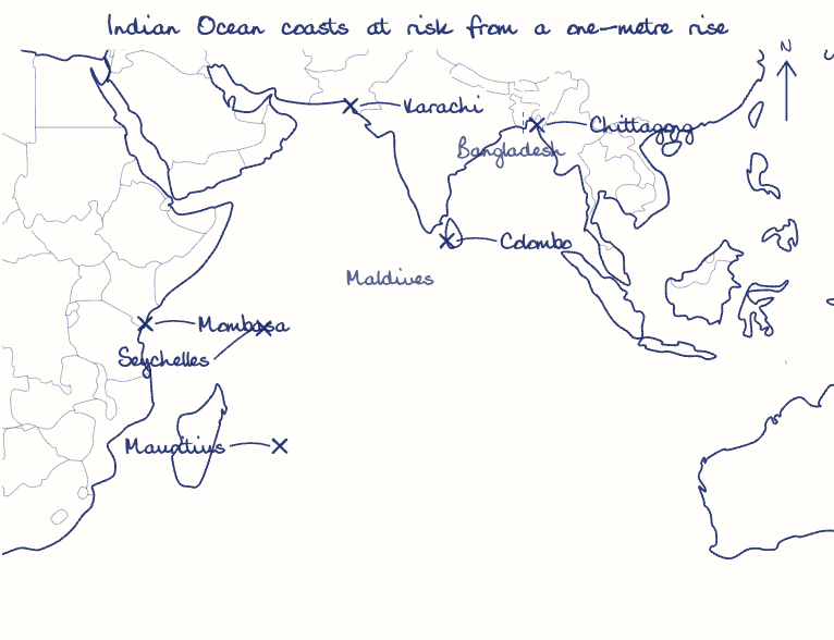
The Intergovernmental Panel on Climate Change (IPCC) has predicted a global sea level rise of about one metre by AD 2100. What would be its impact in India and the other countries in the Indian Ocean region?
In short
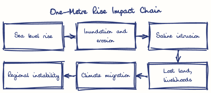
A one-metre sea level rise would flood India's coastal cities and deltas, salinise farmland and aquifers, and drive migration, while threatening the very existence of atoll states across the Indian Ocean. About 80% of the Maldives lies less than a metre above sea level.
Model answer
Ghissu Editorial · Verified 4 Oct 2026 · 298 words
Cities and deltas
Low-lying wards of Mumbai, Kolkata and Chennai would flood, and salt water would invade the Sundarbans, where islands like Ghoramara are already shrinking, and Kerala's below-sea-level Kuttanad.
Ecosystems and livelihoods
About a third of the mainland coast was eroding over 1990-2018 (NCCR); mangroves, Lakshadweep's atolls and fishers' incomes would suffer, adding to the 5.4 million Indians displaced by climate disasters in 2024 (IDMC, 2025).
Atoll states
About 80% of the Maldives lies less than a metre above sea level, so its very statehood is at stake.
Deltas and migration
Bangladesh could see about 17% of its land submerged and some 20 million displaced by 2050 (WEF, 2021), and the World Bank's Groundswell report (2021) warns of 40.5 million South Asian climate migrants, straining India's eastern borders.
Ports and security
Colombo, Chittagong and Mombasa face storm-surge losses, and receding baselines could unsettle maritime zone claims.
Coastal defences
Enforce CRZ 2019, prepare shoreline plans and expand mangroves under MISHTI.
Regional resilience
Share INCOIS warnings through CDRI's island resilience initiative and IORA, and draw on the Loss and Damage Fund for relocation.
This model answer is indicative and the model can make mistakes; please verify key facts independently.
Practise this question
1Get the answer sheet
Sized for this question.
2Write your answer
Timed, by hand.
3Get it marked
Your score and what to fix.
This chapter in the exam
Conservation19 questions
Asked in 11 of 14 sittings since 2013
- 2026Discuss the aim and goals of Kunming-Montreal global biodiversity framework. Mention India's commitments and initiatives to achieve the goals and targets of this framework giving suitable examples. (Answer in 150 words)
- 2025What is Carbon Capture, Utilization and Storage (CCUS) ? What is the potential role of CCUS in tackling climate change ?
All 19 questions, sorted by sub-topic, with model answers and practice.
Question from the official UPSC Civil Services (Main) Examination 2023 paper. Answer written by Ghissu's engine and checked against our editorial standards. Found an error? Tell us and we correct it within 48 hours.