2025 · GS Paper 1 · Q17 · 15 marks
Discuss the distribution and density of population in the Ganga River Basin with special reference to land, soil and water resources.
In short
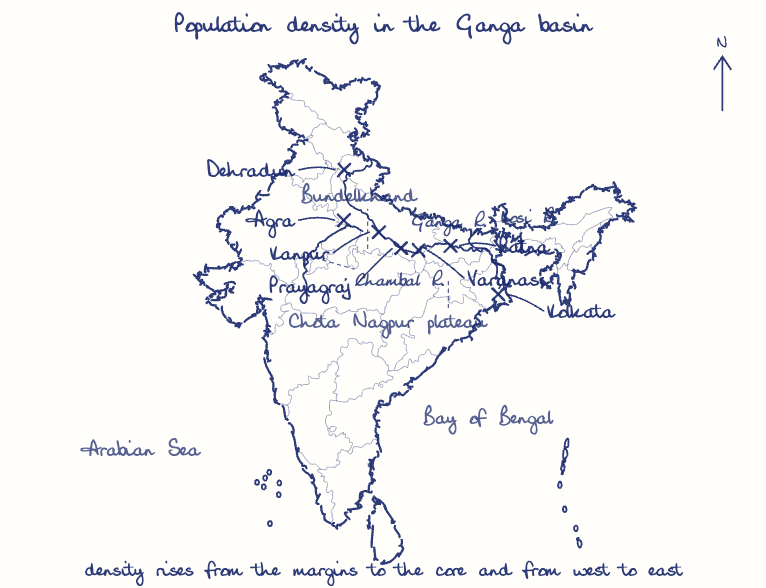
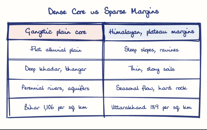
Population in the Ganga basin is densest on the flat, fertile, well-watered alluvial plain and thins out on the Himalayan and peninsular margins, rising from west to east. Bihar records 1,106 persons per sq km against Uttarakhand's 189 (Census 2011).
Model answer
Ghissu Editorial · Verified 4 Oct 2026 · 302 words
Sparse margins
Uttarakhand (189 persons per sq km, Census 2011), the Chambal ravines and Bundelkhand stay thinly settled.
Dense plain
Density climbs from Uttar Pradesh (829) to Bihar (1,106), the highest major state, with river towns from Kanpur to Patna along the main stem.
Delta and terai
West Bengal's delta (1,028) is crowded, and the once marshy terai filled up after post-1950 reclamation.
Land and soil
A level plain of renewed khadar and older bhangar sustains two to three crops a year, while slopes, ravines and usar patches limit settlement.
Water endowment
Snow-fed rivers, the Upper Ganga Canal (1854) and shallow aquifers support rice-wheat farming, and rainfall rising from about 700 mm near Agra to 1,500 mm in Bengal mirrors the density gradient.
Flood paradox
North Bihar's flood-prone Kosi plain stays densely settled because fresh silt outweighs the hazard.
Basin-scale management
Community groundwater budgeting, tapping the 448 untapped drains (CPCB 2024-25) under Namami Gange and Kosi flood cooperation with Nepal will protect the plain.
This model answer is indicative and the model can make mistakes; please verify key facts independently.
Practise this question
1Get the answer sheet
Sized for this question.
2Write your answer
Timed, by hand.
3Get it marked
Your score and what to fix.
This chapter in the exam
Resources and planning38 questions
Asked in 14 of 14 sittings since 2013
- 2026"Water resources are both an asset and a source of conflict in South Asia." Examine this statement giving examples.
- 2026Analyze the role of satellite-based technologies in achieving climate-smart agriculture and food security in India.
All 38 questions, sorted by sub-topic, with model answers and practice.
Question from the official UPSC Civil Services (Main) Examination 2025 paper. Answer written by Ghissu's engine and checked against our editorial standards. Found an error? Tell us and we correct it within 48 hours.