2025 · GS Paper 1 · Q15 · 15 marks
How can Artificial Intelligence (AI) and drones be effectively used along with GIS and RS techniques in locational and areal planning?
In short
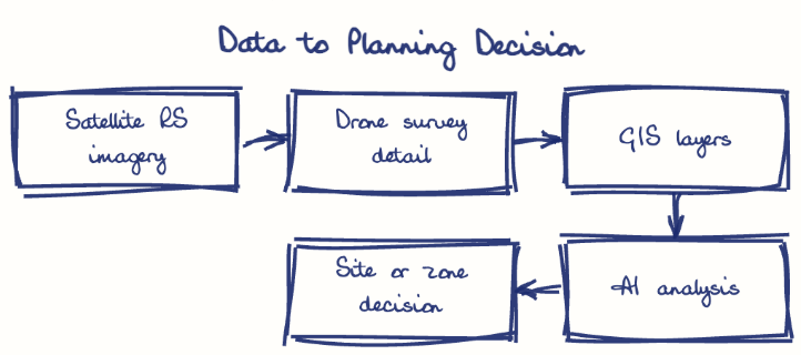
AI and drones complement GIS and remote sensing by adding fine detail and automated analysis, letting planners rank sites, map land and monitor change precisely. SVAMITVA's drone mapping and the GIS-based PM GatiShakti National Master Plan show the combination already at work in India.
Model answer
Ghissu Editorial · Verified 4 Oct 2026 · 282 words
Site suitability
GIS overlays slope, flood risk, roads and ownership, and AI weights the layers to rank sites, as on the PM GatiShakti National Master Plan (2021).
Service location
AI on population and mobility data places schools, clinics and EV chargers where travel time falls most.
Precise ground truth
Drones survey a chosen site at centimetre accuracy before acquisition, while ISRO's Landslide Atlas (2023) keeps roads and towns off unstable Himalayan slopes.
Land records
SVAMITVA gives property cards, and NAKSHA (2025) extends drone survey to urban land for GIS master plans.
Change monitoring
AI on satellite images detects encroachment, illegal mining and sprawl in near real time.
Agriculture and watersheds
RS crop and soil-moisture maps, refined by drone imagery of plots, match land use to soil and water.
Digital twins
Virtual Singapore lets planners test drainage, heat and traffic scenarios before building.
Open data
Share layers under the National Geospatial Policy (2022) through Bhuvan and GatiShakti.
Capacity and safeguards
Train local planners, apply Drone Rules (2021) with privacy safeguards, and validate AI outputs on the ground.
This model answer is indicative and the model can make mistakes; please verify key facts independently.
Practise this question
1Get the answer sheet
Sized for this question.
2Write your answer
Timed, by hand.
3Get it marked
Your score and what to fix.
This chapter in the exam
Resources and planning38 questions
Asked in 14 of 14 sittings since 2013
- 2026"Water resources are both an asset and a source of conflict in South Asia." Examine this statement giving examples.
- 2026Analyze the role of satellite-based technologies in achieving climate-smart agriculture and food security in India.
All 38 questions, sorted by sub-topic, with model answers and practice.
Question from the official UPSC Civil Services (Main) Examination 2025 paper. Answer written by Ghissu's engine and checked against our editorial standards. Found an error? Tell us and we correct it within 48 hours.