2025 · GS Paper 1 · Q7 · 10 marks
What are Tsunamis? How and where are they formed? What are their consequences? Explain with examples.
In short
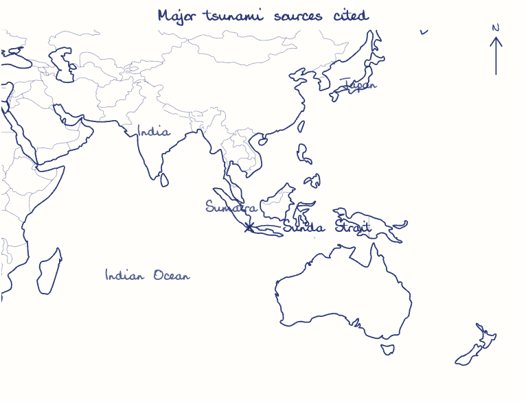
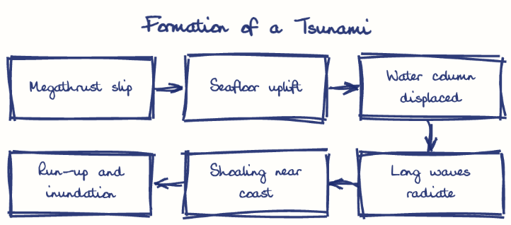
Tsunamis are long, fast ocean waves formed when seawater is suddenly displaced, mostly by shallow subduction earthquakes on the Pacific Ring of Fire and the Sunda trench, and also by volcanoes and landslides. The 2004 Indian Ocean tsunami killed about 2.3 lakh people in 14 countries.
Model answer
Ghissu Editorial · Verified 4 Oct 2026 · 274 words
Subduction earthquakes
Most follow shallow undersea quakes above about magnitude 7.5 where one plate snaps upward, as in Sumatra-Andaman (2004) and Tohoku (2011).
Volcanoes and landslides
Krakatoa (1883), Hunga Tonga (2022) and the Lituya Bay slide in Alaska (1958) also displaced water violently.
Where they occur
About 80% arise on the Pacific Ring of Fire; India faces the Sunda trench and the Makran zone, whose 1945 tsunami reached Mumbai.
Loss of life
The 2004 Indian Ocean tsunami killed about 2.3 lakh people in 14 countries, over 10,000 of them in India, worst in Nagapattinam and Car Nicobar.
Cascading disaster
In 2011 the waves overtopped Fukushima Daiichi's sea wall and caused a nuclear meltdown.
Land and livelihoods
Salt water spoiled Tamil Nadu's coastal farms and wells, and fishing communities lost boats and homes, though villages behind the Pichavaram mangroves suffered far less.
This model answer is indicative and the model can make mistakes; please verify key facts independently.
Practise this question
1Get the answer sheet
Sized for this question.
2Write your answer
Timed, by hand.
3Get it marked
Your score and what to fix.
This chapter in the exam
Water (Oceans)4 questions
Asked in 4 of 14 sittings since 2013
- 2024What is sea surface temperature rise? How does it affect the formation of tropical cyclones?
- 2019Assess the impact of global warming on the coral life system with examples.
All 4 questions, sorted by sub-topic, with model answers and practice.
Question from the official UPSC Civil Services (Main) Examination 2025 paper. Answer written by Ghissu's engine and checked against our editorial standards. Found an error? Tell us and we correct it within 48 hours.