What is the role of Indian Space Program in agricultural and rural developmental activities ?
In short
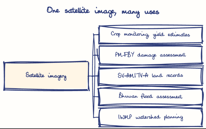
The Indian Space Program, led by ISRO, supports agriculture and rural development through satellite crop monitoring, yield forecasting, soil and water mapping, disaster assessment and digital land records. Its data speeds up crop insurance under PMFBY and land titling under SVAMITVA, helping drought-prone regions such as Rayalaseema in Andhra Pradesh.
Model answer
Ghissu Editorial · Verified 4 Oct 2026 · 265 words
Soil and Water Management
Satellite data supports precision agriculture and programs like Integrated Watershed Management Programme (IWMP) and On Farm Water Management (OFWM), addressing drought-prone areas such as Rayalaseema in Andhra Pradesh.
Digital Land Records and Property Rights
The Digital India Land Records Modernization Program (DILRMP) and SVAMITVA scheme use satellite imagery to regularize land ownership, reducing disputes and improving credit access in rural Andhra Pradesh.
Socio-Economic Growth
Space technology has contributed to a 10.7% GVA growth in Andhra Pradesh’s agriculture sector (2024-25), improving productivity and resource use.
Governance Gaps
CAG audits reveal implementation gaps in welfare and nutrition schemes in Andhra Pradesh, highlighting the need for better integration of space data with rural programs like MGNREGA and AIBP.
Capacity Building and Access
Strengthening training and promoting affordable satellite data services for small farmers in Andhra Pradesh is essential.
Data Governance
Transparent data-sharing and monitoring mechanisms are needed to enhance the impact of space-enabled rural initiatives.
This model answer is indicative and the model can make mistakes; please verify key facts independently.
Practise this question
1Get the answer sheet
Sized for this question.
2Write your answer
Timed, by hand.
3Get it marked
Your score and what to fix.
This chapter in the exam
Indian Space Programme, ISRO, Satellites and DRDO23 questions
Asked in 8 of 8 sittings since 2008
Most tested: Remote sensing and satellite applications for agriculture, natural resources, and rural development.
- 2025Describe the role of the Indian Remote Sensing (IRS) satellite programme. How do these satellites assist in natural resource management?
- 2025Discuss the vision and mission of DRDO? Describe the role of DRDO in the contribution to national development.
All 23 questions, sorted by sub-topic, with model answers and practice.
Question from the official APPSC Group-I Mains 2008 paper. Answer written by Ghissu's engine and checked against our editorial standards. Found an error? Tell us and we correct it within 48 hours.