Illustrate the role of Indian Space Programmes on (i) Rural India (ii) Natural Resources
In short
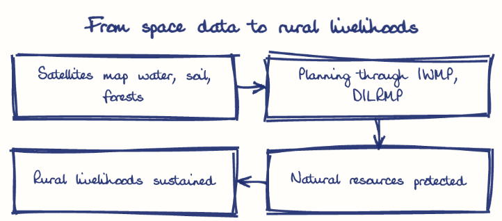
Indian space programmes help rural India through precision farming, groundwater mapping, disaster warning and infrastructure planning, and help natural resources through inventories of land, forests and minerals, ecosystem monitoring and weather forecasting. Tools like RESOURCESAT and the Bhuvan geoportal, backed by launches from Sriharikota in Andhra Pradesh, deliver these services.
Model answer
Ghissu Editorial · Verified 4 Oct 2026 · 282 words
Precision Agriculture and Crop Insurance
RESOURCESAT’s high-resolution imagery enables crop health monitoring, supporting Pradhan Mantri Fasal Bima Yojana4 (PMFBY) for transparent insurance claims.
Water Resource Management
Satellite data aids irrigation planning under Pradhan Mantri Krishi Sinchayee Yojana and watershed management in drought-prone Rayalaseema, complementing irrigation projects like the Polavaram Project5.
Disaster Preparedness
ISRO’s Bhuvan portal offers near real-time flood and drought data, enhancing disaster response along Andhra Pradesh’s coastline.
Rural Governance
GIS and SVAMITVA6 scheme use satellite data for infrastructure planning and property records, empowering gram panchayats in Andhra Pradesh.
Resource Inventory and Mining Oversight
Remote sensing supports land use and mineral resource monitoring, addressing audit-flagged compliance gaps in Andhra Pradesh mines.
Environmental Conservation
Satellite data monitors forest health and coastal ecosystems, aiding biodiversity conservation in Andhra Pradesh.
Land Records and Watershed Management
Digital India Land Records Modernization Program (DILRMP) and Integrated Watershed Management Programme (IWMP) use satellite data for sustainable land and water use.
Capacity Building
Train panchayats in space data use for decentralized planning, focusing on Andhra Pradesh.
Data Integration
Link satellite data with agricultural extension services like Kisan Call Centres.
Public-Private Partnerships
Promote private innovation in space applications, leveraging Andhra Pradesh’s tech ecosystem.
Digital Infrastructure
Enhance rural internet access via BharatNet for effective space data utilization.
This model answer is indicative and the model can make mistakes; please verify key facts independently.
Practise this question
1Get the answer sheet
Sized for this question.
2Write your answer
Timed, by hand.
3Get it marked
Your score and what to fix.
This chapter in the exam
Indian Space Programme, ISRO, Satellites and DRDO23 questions
Asked in 8 of 8 sittings since 2008
Most tested: Remote sensing and satellite applications for agriculture, natural resources, and rural development.
- 2025Describe the role of the Indian Remote Sensing (IRS) satellite programme. How do these satellites assist in natural resource management?
- 2025Discuss the vision and mission of DRDO? Describe the role of DRDO in the contribution to national development.
All 23 questions, sorted by sub-topic, with model answers and practice.
Question from the official APPSC Group-I Mains 2011 paper. Answer written by Ghissu's engine and checked against our editorial standards. Found an error? Tell us and we correct it within 48 hours.