How many satellites are tracked at a time for a GPS? Explain how and for what purpose the GPS is used.
In short
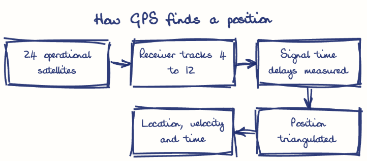
A GPS receiver needs signals from at least four of the 24 operational satellites and usually tracks 4 to 12 at once, using signal delays to fix position, velocity and time. GPS serves defence, aviation (augmented by GAGAN), disaster management and everyday navigation, while India builds NavIC for strategic autonomy.
Model answer
Ghissu Editorial · Verified 4 Oct 2026 · 261 words
Tracking Multiple Satellites
GPS receivers track 4 to 12 satellites from a 24-satellite constellation, ensuring accuracy through signal triangulation and redundancy, which is crucial in urban and challenging terrains.
Interoperability with GNSS
Combining GPS with GLONASS, Beidou, and NavIC enhances coverage and precision in diverse terrains like Andhra Pradesh, improving reliability and service continuity.
Defence and Strategic Autonomy
GPS guides precision weaponry and troop movements; NavIC reduces dependence on foreign systems during crises, ensuring secure regional navigation autonomy.
Civil Aviation and Disaster Management
GAGAN augments GPS for safer air traffic management over Indian airspace; GPS aids disaster response, agricultural planning, and coastal monitoring in Andhra Pradesh, supporting resilience and governance.
Signal Vulnerability and Infrastructure
Weak GPS signals require augmentation systems like GAGAN; ongoing NavIC satellite launches from Sriharikota aim to boost indigenous capacity and improve regional coverage.
Enhancing Security and Partnerships
Strengthening anti-jamming and anti-spoofing measures alongside fostering public-private collaboration will improve GPS applications under schemes like Digital Bharat Nidhi1 and Amended BharatNet Program, especially in rural and remote areas.
This model answer is indicative and the model can make mistakes; please verify key facts independently.
Practise this question
1Get the answer sheet
Sized for this question.
2Write your answer
Timed, by hand.
3Get it marked
Your score and what to fix.
This chapter in the exam
Indian Space Programme, ISRO, Satellites and DRDO23 questions
Asked in 8 of 8 sittings since 2008
Most tested: Remote sensing and satellite applications for agriculture, natural resources, and rural development.
- 2025Describe the role of the Indian Remote Sensing (IRS) satellite programme. How do these satellites assist in natural resource management?
- 2025Discuss the vision and mission of DRDO? Describe the role of DRDO in the contribution to national development.
All 23 questions, sorted by sub-topic, with model answers and practice.
Question from the official APPSC Group-I Mains 2012 paper. Answer written by Ghissu's engine and checked against our editorial standards. Found an error? Tell us and we correct it within 48 hours.