What is a Satellite? Explain the different types of Satellites in the Space programme. Add a note on GSAT-5.
In short
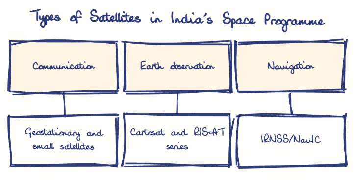
A satellite is an artificial object placed in orbit to relay communication, observe the Earth or navigate, and India's fleet has geostationary communication satellites, small LEO satellites, Cartosat and RISAT earth observation satellites and NavIC navigation satellites. GSAT-5P, a C-band satellite, was lost when GSLV-F06 failed on 25 December 2010.
Model answer
Ghissu Editorial · Verified 4 Oct 2026 · 319 words
Geostationary and Small Satellites
GEOSATs orbit at 36,000 km for continuous coverage but have high latency; SmSats (<500 kg) in Low Earth Orbit1 offer low latency, cost-effective communication, and rapid deployment, supported by ISRO’s Small Satellite Launch Vehicle (SSLV).
Earth Observation and Navigation
Cartosat and RISAT series provide remote sensing and Synthetic Aperture Radar imaging for resource management and surveillance; IRNSS/NavIC offers precise regional navigation services, enhancing strategic and civilian applications.
Launch Capacity and Strategic Use
India launches 5-7 satellites yearly using PSLV and GSLV; CMS-032, the heaviest Indian satellite, enhances naval communication, reflecting realist power projection and growing indigenous launch capabilities.
Commercial and Defence Applications
GSAT satellites support telecommunication and broadband, bridging digital divides; military satellites like GSAT-7 and RISAT improve C4ISR capabilities; SmSats enable Beyond Line of Sight (BLOS) communication and network resilience.
Indigenous Capacity and Digital Inclusion
Expand high-throughput satellites like GSAT-11 and GSAT-29 to reduce leased bandwidth, especially in Andhra Pradesh; enhance SmSat constellations for real-time data, improved coverage, and security.
This model answer is indicative and the model can make mistakes; please verify key facts independently.
Sources
Practise this question
1Get the answer sheet
Sized for this question.
2Write your answer
Timed, by hand.
3Get it marked
Your score and what to fix.
This chapter in the exam
Indian Space Programme, ISRO, Satellites and DRDO23 questions
Asked in 8 of 8 sittings since 2008
Most tested: Remote sensing and satellite applications for agriculture, natural resources, and rural development.
- 2025Describe the role of the Indian Remote Sensing (IRS) satellite programme. How do these satellites assist in natural resource management?
- 2025Discuss the vision and mission of DRDO? Describe the role of DRDO in the contribution to national development.
All 23 questions, sorted by sub-topic, with model answers and practice.
Question from the official APPSC Group-I Mains 2012 paper. Answer written by Ghissu's engine and checked against our editorial standards. Found an error? Tell us and we correct it within 48 hours.