Explain the applications of Remote Sensing technology in agriculture.
In short
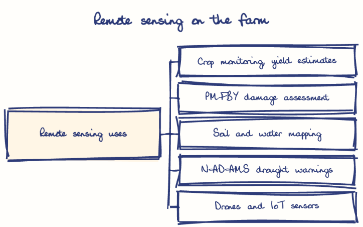
Remote sensing helps agriculture by monitoring crop health, estimating yields, mapping soil and water resources and enabling precision farming with drones and IoT. ISRO satellites like Resourcesat and RISAT speed up crop damage assessment under PMFBY, which matters for drought-prone Rayalaseema and the cyclone-exposed coast of Andhra Pradesh.
Model answer
Ghissu Editorial · Verified 4 Oct 2026 · 274 words
ISRO’s Satellite Network
ISRO’s IRS, Resourcesat, and RISAT satellites provide essential data for agricultural monitoring, coordinated by the National Remote Sensing Centre in Hyderabad and the Mahalanobis National Crop Forecast Centre.
Government Scheme Integration
Remote sensing supports schemes like Pradhan Mantri Fasal Bima Yojana1 (PMFBY), expediting crop damage assessments and insurance claims, with Andhra Pradesh seeing faster compensation during droughts and pest outbreaks.
Crop and Soil Monitoring
Satellites enable early detection of pests, nutrient deficiencies, and water stress, improving yield forecasts and market planning; Andhra Pradesh’s chilli and horticulture sectors have benefited significantly.
Water Resource Management
Programs like NADAMS use remote sensing for drought warnings, aiding water management in Rayalaseema’s drought-prone region.
Precision Farming Technologies
Drones and IoT devices enhance field analysis and irrigation automation; the Namo Drone Didi2 scheme in Andhra Pradesh exemplifies inclusive tech adoption.
Data Integration
Combining satellite data with AI and weather forecasts via apps like Kisan Suvidha and Meghdoot empowers farmers with real-time advisories and market info.
Strengthen State Capacity
Build remote sensing infrastructure and expertise in Andhra Pradesh for localized applications.
Expand Farmer Training
Promote digital literacy and extension services to boost adoption among smallholders.
Encourage Partnerships
Foster collaboration among government, private sector, and farmers for sustainable innovation.
This model answer is indicative and the model can make mistakes; please verify key facts independently.
Practise this question
1Get the answer sheet
Sized for this question.
2Write your answer
Timed, by hand.
3Get it marked
Your score and what to fix.
This chapter in the exam
Indian Space Programme, ISRO, Satellites and DRDO23 questions
Asked in 8 of 8 sittings since 2008
Most tested: Remote sensing and satellite applications for agriculture, natural resources, and rural development.
- 2025Describe the role of the Indian Remote Sensing (IRS) satellite programme. How do these satellites assist in natural resource management?
- 2025Discuss the vision and mission of DRDO? Describe the role of DRDO in the contribution to national development.
All 23 questions, sorted by sub-topic, with model answers and practice.
Question from the official APPSC Group-I Mains 2016 paper. Answer written by Ghissu's engine and checked against our editorial standards. Found an error? Tell us and we correct it within 48 hours.