What is GPS ? Explain the recent efforts made by India to create its own GPS system.
In short
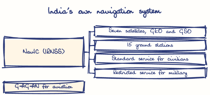
GPS is a satellite navigation system giving real-time location and timing worldwide, and denial of access during the Kargil War pushed India to build its own. Its answer is NavIC (IRNSS), seven ISRO satellites with 15 ground stations, giving better than 20 metre accuracy over India and 1,500 km beyond.
Model answer
Ghissu Editorial · Verified 4 Oct 2026 · 265 words
ISRO and Ground Network
ISRO leads NAVIC’s design, launch, and operation, supported by 15 ground stations for satellite control and navigation management.
GAGAN for Aviation
Collaboration between ISRO and Airport Authority of India enhances GPS accuracy over Indian airspace, improving civil aviation safety.
Strategic Autonomy Focus
The Ministry of Defence and Department of Space prioritize reducing dependence on foreign systems like US GPS and Russian GLONASS for military use.
Dual-Use Applications
It supports Andhra Pradesh’s coastal fisheries, disaster relief, and maritime safety, boosting regional economic activity.
Interoperability Efforts
NAVIC receivers work alongside GPS and GLONASS, though seamless compatibility and interference remain challenges.
Operationalization and Adoption
Full operational status is ongoing, with efforts to integrate NAVIC into commercial devices and government services, including Andhra Pradesh’s disaster frameworks.
Expand Satellite Constellation
Launch more satellites and upgrade ground infrastructure for robust service.
Promote Indigenous Manufacturing
Support local production under Make in India1 to reduce imports.
Enhance Civil-Military Integration
Improve coordination for coastal security and disaster response in Andhra Pradesh.
International Collaboration
Engage in interoperability agreements to improve accuracy and strategic partnerships.
This model answer is indicative and the model can make mistakes; please verify key facts independently.
Sources
Practise this question
1Get the answer sheet
Sized for this question.
2Write your answer
Timed, by hand.
3Get it marked
Your score and what to fix.
This chapter in the exam
Indian Space Programme, ISRO, Satellites and DRDO23 questions
Asked in 8 of 8 sittings since 2008
Most tested: Remote sensing and satellite applications for agriculture, natural resources, and rural development.
- 2025Describe the role of the Indian Remote Sensing (IRS) satellite programme. How do these satellites assist in natural resource management?
- 2025Discuss the vision and mission of DRDO? Describe the role of DRDO in the contribution to national development.
All 23 questions, sorted by sub-topic, with model answers and practice.
Question from the official APPSC Group-I Mains 2017 paper. Answer written by Ghissu's engine and checked against our editorial standards. Found an error? Tell us and we correct it within 48 hours.