2013 · GS Paper 1 · Q22(a) · 5 marks
Bring out the causes for more frequent occurrence of landslides in the Himalayas than in the Western Ghats.
In short
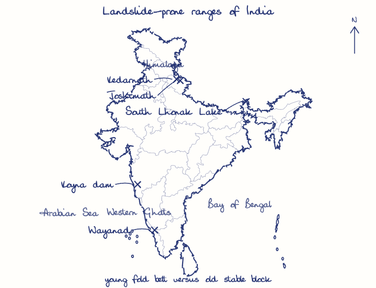
The Himalaya slides more often than the Western Ghats because its young, seismic, fragile fold belt meets cloudbursts, snowmelt and construction, while the Ghats are an old, stable block. The ISRO Landslide Atlas (2023) attributes about 85% of mapped landslides to the Himalaya against 14.7% to the Western Ghats.
Model answer
Ghissu Editorial · Verified 4 Oct 2026 · 307 words
Active tectonics
The Indian plate still pushes into Eurasia, so the Himalaya is a rising fold belt cut by the Main Central and Main Boundary Thrusts, while the Ghats are the edge of the stable Peninsular block.
Fragile rock
Shales, schists and loose glacial debris dominate Himalayan slopes, whereas the Ghats are compact Deccan basalt and gneiss.
Seismic triggering
Lying in India's highest seismic hazard belt, Himalayan slopes are shaken loose often; the 2005 Kashmir and 2015 Nepal earthquakes each set off thousands of landslides, while the Ghats rarely face such shocks.
Extreme precipitation
Monsoon-western disturbance cloudbursts, as at Kedarnath in 2013, plus snowmelt and glacial lake outbursts like South Lhonak (2023), are triggers the snow-free Ghats lack.
River undercutting
Perennial, snow-fed rivers like the Alaknanda and Teesta erode the toe of slopes all year in deep gorges, unlike the seasonal Ghat streams.
Development load
Roads, tunnels and unplanned towns on weak slopes worsened the Joshimath subsidence (2023), though Wayanad (2024) shows the Ghats are not immune.
This model answer is indicative and the model can make mistakes; please verify key facts independently.
Practise this question
1Get the answer sheet
Sized for this question.
2Write your answer
Timed, by hand.
3Get it marked
Your score and what to fix.
This chapter in the exam
Natural Hazards and Disasters6 questions
Asked in 5 of 14 sittings since 2013
- 2023Comment on the resource potentials of the long coastline of India and highlight the status of natural hazard preparedness in these areas.
- 2021Differentiate the causes of landslides in the Himalayan region and Western Ghats.
All 6 questions, sorted by sub-topic, with model answers and practice.
Question from the official UPSC Civil Services (Main) Examination 2013 paper. Answer written by Ghissu's engine and checked against our editorial standards. Found an error? Tell us and we correct it within 48 hours.