2013 · GS Paper 1 · Q21 · 10 marks
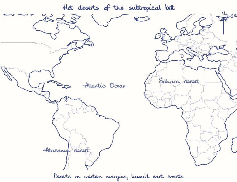
Major hot deserts in northern hemisphere are located between 20-30° N latitudes and on the western side of the continents. Why?
In short
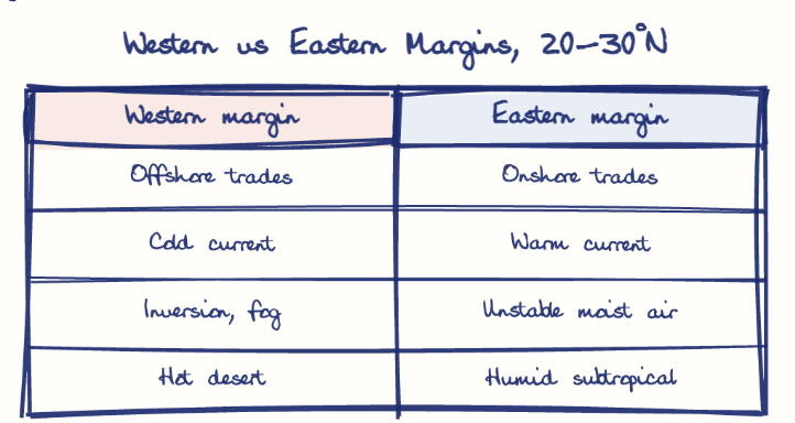
Hot deserts lie at 20-30°N because the sinking, adiabatically warming air of the subtropical high suppresses rain, and on western margins because offshore trade winds and cold currents keep moisture away. The Canary and California currents, for instance, chill coastal air into fog-bearing but rainless inversions.
Model answer
Ghissu Editorial · Verified 4 Oct 2026 · 285 words
Subtropical high pressure
The Hadley cell's descending limb sinks near 25-30°N, and the sinking air warms adiabatically, so relative humidity falls and clouds cannot form.
Capped atmosphere
Subsidence builds a trade-wind inversion that lids rising air, suppressing the convection needed for rain.
Outside both rain belts
The band lies beyond the ITCZ's convective rain and the westerlies' cyclones, and cloudless skies under a high sun let insolation scorch the surface by day.
Offshore trade winds
The north-east trades blow from east to west, watering eastern coasts like south China and Florida but reaching western margins only after crossing dry land.
Cold ocean currents
The Canary and California currents chill the air above them, creating an inversion that brings coastal fog but almost no rain.
Relief barriers
The Sierra Nevada shadows the Mojave, and the Aravallis, parallel to the monsoon winds, leave the Thar dry.
This model answer is indicative and the model can make mistakes; please verify key facts independently.
Practise this question
1Get the answer sheet
Sized for this question.
2Write your answer
Timed, by hand.
3Get it marked
Your score and what to fix.
This chapter in the exam
Landforms5 questions
Asked in 5 of 14 sittings since 2013
- 2026Discuss the role of aeolian processes in desertification and land degradation.
- 2023How are the fjords formed? Why do they constitute some of the most picturesque areas of the world?
All 5 questions, sorted by sub-topic, with model answers and practice.
Question from the official UPSC Civil Services (Main) Examination 2013 paper. Answer written by Ghissu's engine and checked against our editorial standards. Found an error? Tell us and we correct it within 48 hours.