(i) Comment on "Chandrayan" Programme. (ii) Discuss two salient features of IRS-5 Satellite.
In short
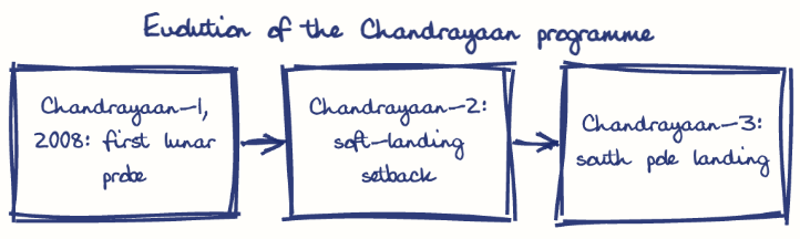
The Chandrayaan programme, begun with Chandrayaan-1 in 2008, is ISRO's indigenous lunar exploration effort that has advanced from orbiters to the Chandrayaan-3 landing despite Chandrayaan-2's setback. IRS-P5 (Cartosat-1), launched in 2005 by PSLV-C6, has two 2.5 m panchromatic cameras and same-pass stereo imaging for accurate elevation models.
Model answer
Ghissu Editorial · Verified 4 Oct 2026 · 257 words
ISRO’s Indigenous Development
Chandrayaan missions leverage ISRO’s launch vehicle advancements like PSLV and GSLV Mk-III, enabling cost-effective lunar exploration since 2008.
Salient Features of IRS-P5
IRS-P5 (Cartosat-1) carries two 2.5 m panchromatic cameras that take along-track stereo images for terrain models and large-scale maps, and flies in a sun-synchronous orbit for consistent coverage, supporting schemes such as Integrated Watershed Management Programme1 (IWMP) in Andhra Pradesh.
Mission Risks and Resilience
Chandrayaan-2’s soft-landing failure was followed by Chandrayaan-32’s successful 2023 lunar south pole landing, demonstrating ISRO’s learning curve.
Data Accessibility Issues
IRS-P5 data’s potential is limited by rural infrastructure gaps; initiatives like ISRO’s Bhuvan geo-portal and Village Resource Centres aim to improve data use in Andhra Pradesh.
Enhancing Indigenous R&D
Continued investment in payloads and launch tech will boost mission reliability and reduce foreign dependence.
Expanding Rural Applications
Using IRS-P5 terrain maps for schemes like the Accelerated Irrigation Benefit Programme (AIBP) can improve resource management in Andhra Pradesh.
Improving Training and Infrastructure
Strengthening digital infrastructure and user training in rural areas will enhance satellite data utilization.
International Collaboration and Commercialisation
ISRO’s foreign satellite launches can expand India’s space economy while maintaining strategic autonomy.
This model answer is indicative and the model can make mistakes; please verify key facts independently.
Practise this question
1Get the answer sheet
Sized for this question.
2Write your answer
Timed, by hand.
3Get it marked
Your score and what to fix.
This chapter in the exam
Indian Space Programme, ISRO, Satellites and DRDO23 questions
Asked in 8 of 8 sittings since 2008
Most tested: Remote sensing and satellite applications for agriculture, natural resources, and rural development.
- 2025Describe the role of the Indian Remote Sensing (IRS) satellite programme. How do these satellites assist in natural resource management?
- 2025Discuss the vision and mission of DRDO? Describe the role of DRDO in the contribution to national development.
All 23 questions, sorted by sub-topic, with model answers and practice.
Question from the official APPSC Group-I Mains 2011 paper. Answer written by Ghissu's engine and checked against our editorial standards. Found an error? Tell us and we correct it within 48 hours.