Write a short note on: (i) Mobile Satellite Services (MSS) (ii) Environmental monitoring
In short
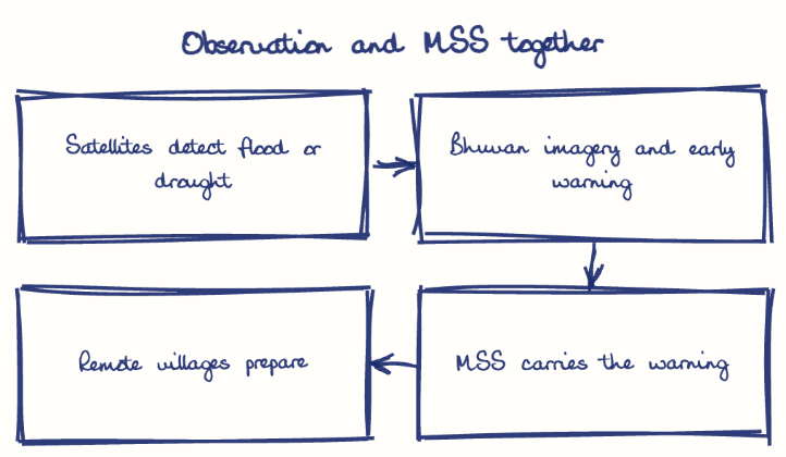
Mobile Satellite Services (MSS) give voice and data links by satellite to users on the move, such as ships, aircraft and handheld terminals, while environmental monitoring uses satellites to track weather, land, water, forests and oceans. Assets like CMS-03 and INSAT-3D aid cyclone warnings and drought monitoring in Andhra Pradesh.
Model answer
Ghissu Editorial · Verified 4 Oct 2026 · 274 words
ISRO’s Satellite Leadership
CMS-03 supports strategic communication in the Indian Ocean; the INSAT-3D series aids weather monitoring, reflecting strong space tech capacity.
State-Level Integration
Andhra Pradesh uses satellite data in MGNREGA and PMFBY, integrating satellite data into rural development3 and agriculture. The National Remote Sensing Centre (NRSC) also regulates data distribution, ensuring secure and efficient use of satellite imagery.
Connectivity Gaps
Rural internet tele-density at 46.73%4 limits MSS reach; GSAT-11 targets improved broadband in rural and coastal Andhra Pradesh. This aims to bridge digital divides and support inclusive growth.
Telemedicine and Social Inclusion
MSS enables telemedicine linking remote Andhra Pradesh hospitals to urban centres, reducing healthcare disparities. Partnerships with the National Health Resource Repository (NHRR) enhance these services.
Environmental Monitoring
Remote sensing aids forest and water resource management in ecologically sensitive zones like the Eastern Ghats. It also supports agricultural advisories and soil health monitoring, boosting sustainability.
Boost Indigenous Satellites
Enhance ISRO’s development of cost-effective MSS satellites for rural and coastal needs in Andhra Pradesh.
Integrate Satellite Data
Use satellite data in schemes like AIBP and IWMP for better water and agricultural management. Strengthening skilled workforce development is also essential for effective implementation.
This model answer is indicative and the model can make mistakes; please verify key facts independently.
Practise this question
1Get the answer sheet
Sized for this question.
2Write your answer
Timed, by hand.
3Get it marked
Your score and what to fix.
This chapter in the exam
Indian Space Programme, ISRO, Satellites and DRDO23 questions
Asked in 8 of 8 sittings since 2008
Most tested: Remote sensing and satellite applications for agriculture, natural resources, and rural development.
- 2025Describe the role of the Indian Remote Sensing (IRS) satellite programme. How do these satellites assist in natural resource management?
- 2025Discuss the vision and mission of DRDO? Describe the role of DRDO in the contribution to national development.
All 23 questions, sorted by sub-topic, with model answers and practice.
Question from the official APPSC Group-I Mains 2016 paper. Answer written by Ghissu's engine and checked against our editorial standards. Found an error? Tell us and we correct it within 48 hours.